On July 28th we finally made it to Mount Saint Helens. Of course, that was after morning snuggles for Bailey…
After departing our campsite at 10am, we made a few stops in the towns of Longview and Kelso. Wal-Mart (paper towels and almonds), Winco (to fill the water containers) and Safeway (for gas). Too bad we couldn’t find those three things at the same store, but what can you do?
Along the way to the MSH Visitor’s Center, we stopped at a little roadside fruit stand and picked up Yakima peaches. This might sound a little odd but I hadn’t had a peach since October. That was waaay back in Moab, when we were buying a 5-lb bag of Palisade peaches at the same roadside stand once a week.
After that experience I said that I’d never eat any other kind of peach. Palisade peaches were the best.
Now, I’m not going to change my tune and say that Palisade peaches are not the best… But those Yakima peaches were damn tasty.
My point is that eventually we made it to the Visitor’s Center for Mount Saint Helens. We have a National Parks annual pass, and that gets us in to National Monuments as well. But the Visitor’s Center for MSH was also a learning center and they charged their own fee of $5/person to get in and learn. We paid it so we could watch the 13-minute video about the eruption of Mount Saint Helens on May 18, 1980. There were also lots of cool exhibits about the volcano and the aftermath of the explosion.
I didn’t realize that the area around the mountain had actually been evacuated 7 weeks before the big eruption. There were several scary signs (like bulges) and events (like small earthquakes) that led to the evacuation. However, during that 7 weeks only a few smaller eruptions and earthquakes were recorded. Nothing catastrophic and so people were getting antsy. For me, when I looked around the area and saw how isolated these towns are, their reaction made sense. Seven weeks is a long time to be out of your home, especially when the coast seems clear.
On May 17, a small group (50 carloads) was allowed back in to the area to check on their homes. That went well so another group was scheduled to go in at 10am the next day.
Mount Saint Helens erupted at 8:32am on May 18.
There is no video of the eruption but photographer Gary Rosenquist captured a series of images that were pieced together to show what happened. It was actually quite stunning to watch. (I found a link to his photographs here.)
Harder to think about: the 57 people who died. Only three of those were actually in the evacuated area. In spite of all the knowledge, nobody predicted that the mountain would blow out on its north side.
After watching the video, seeing the exhibits, and trying to imagine destruction on that scale (the eruption alone blew down 230 acres of forest), we finally came face to face with Mount Saint Helens.
I found the crater that is now the top of the mountain to actually be a wee bit sinister. It looked like a gaping mouth, especially when you consider that from that gaping mouth came the largest landslide in US history, one that covered a total of 24 square miles and filled the Toutle River Valley with debris up to 600 feet deep. And even more especially when you consider that MSH is still active. New lava domes began forming inside the crater in 2004, although that activity was considered finished in 2008 and the mountain has been relatively quiet ever since. Sill. The closer we got, the more ominous that crater looked.
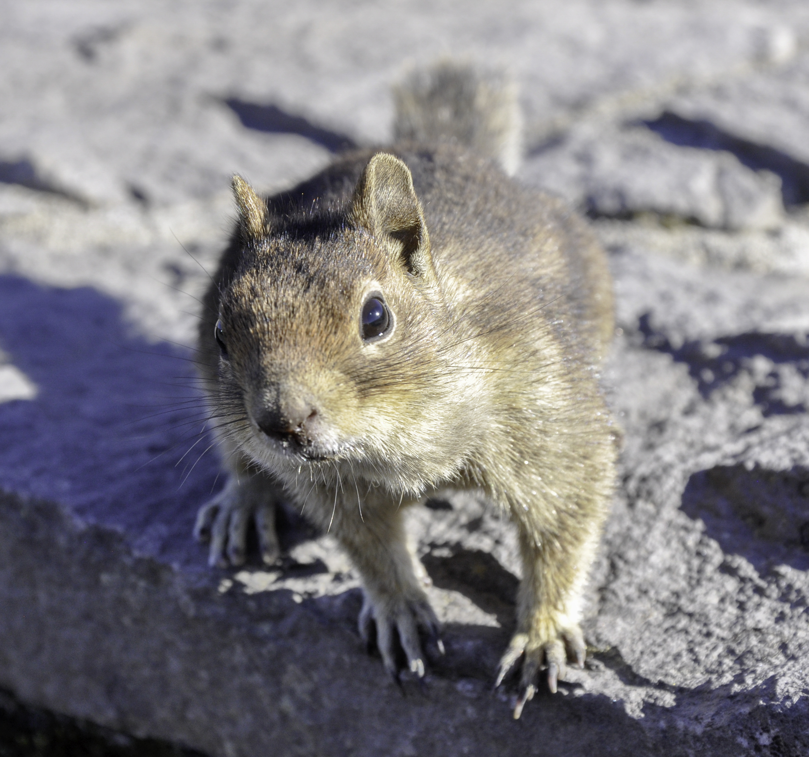
On a lighter note, we found some local “wildlife.”
What we did not find was a place camp. Our Gazetter showed a small strip of National Forest land just outside the National Monument boundary. But none of the local maps showed any such thing. And we couldn’t find any roads to turn off that were open. These were logging roads, and they were closed off by gates.
We had to drop back and punt. Michael found us a spot outside the town of Randle, Washington. I think the area was supposed to be a wildlife area? Generally camping isn’t allowed in places like that. But when we arrived there were at least 10 other cars in the parking lot. Tired, we set up shop and crawled up into the tent.
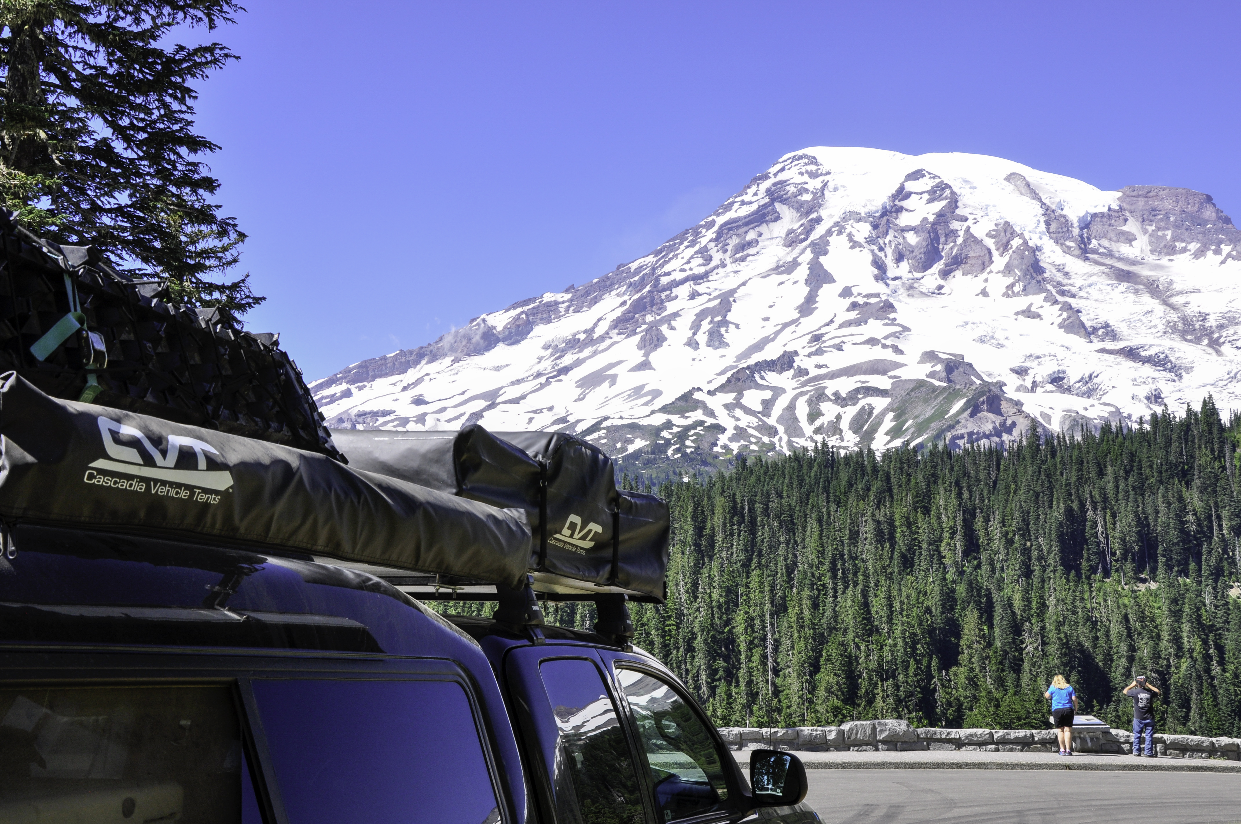
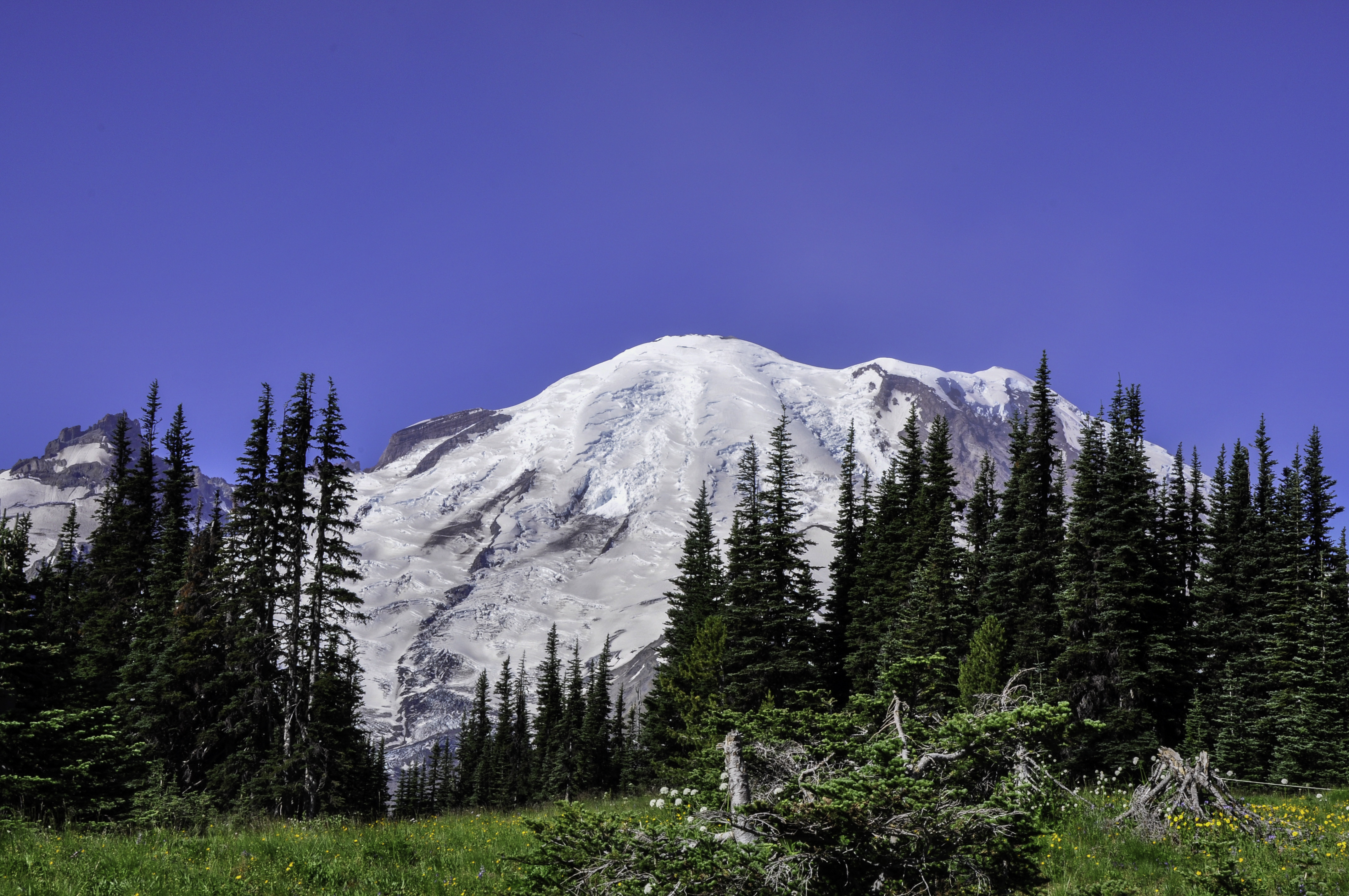
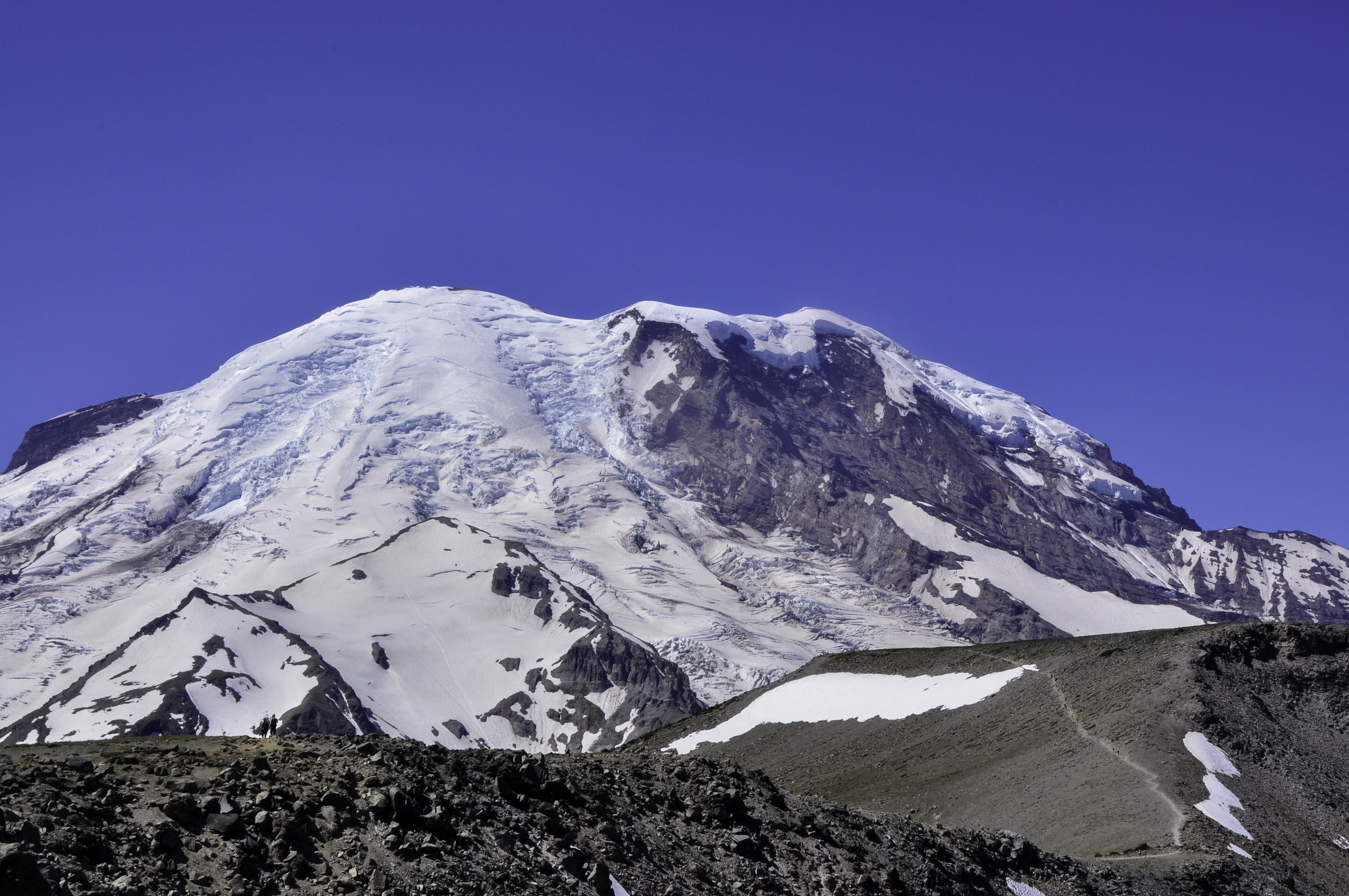
The next day (a Saturday) we drove to Mount Rainier National Park. We waited 30 minutes in line just to get in the Nisqually entrance on the west side, but it was totally worth it. I can’t believe we almost passed on the opportunity to come here – Rainier is astounding. The top of the mountain (an active volcano, it last erupted in 1894) is covered in glaciers.
Traffic was surprisingly not that bad. Everyone flocked to an area called Paradise (with good reason, it looked gorgeous) and by the time we got there the parking lot was full. They still let cars drive through, through, so we joined that little shitshow for a while.
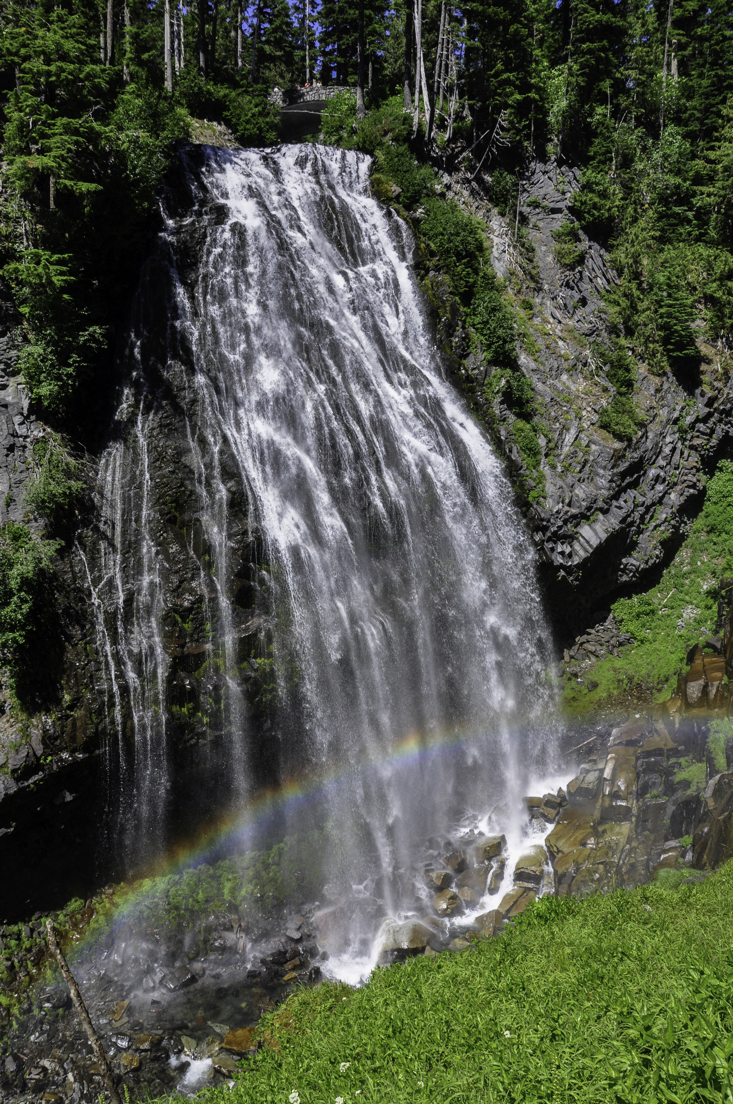
There were plenty of other places to take pictures. Like Narada Falls.
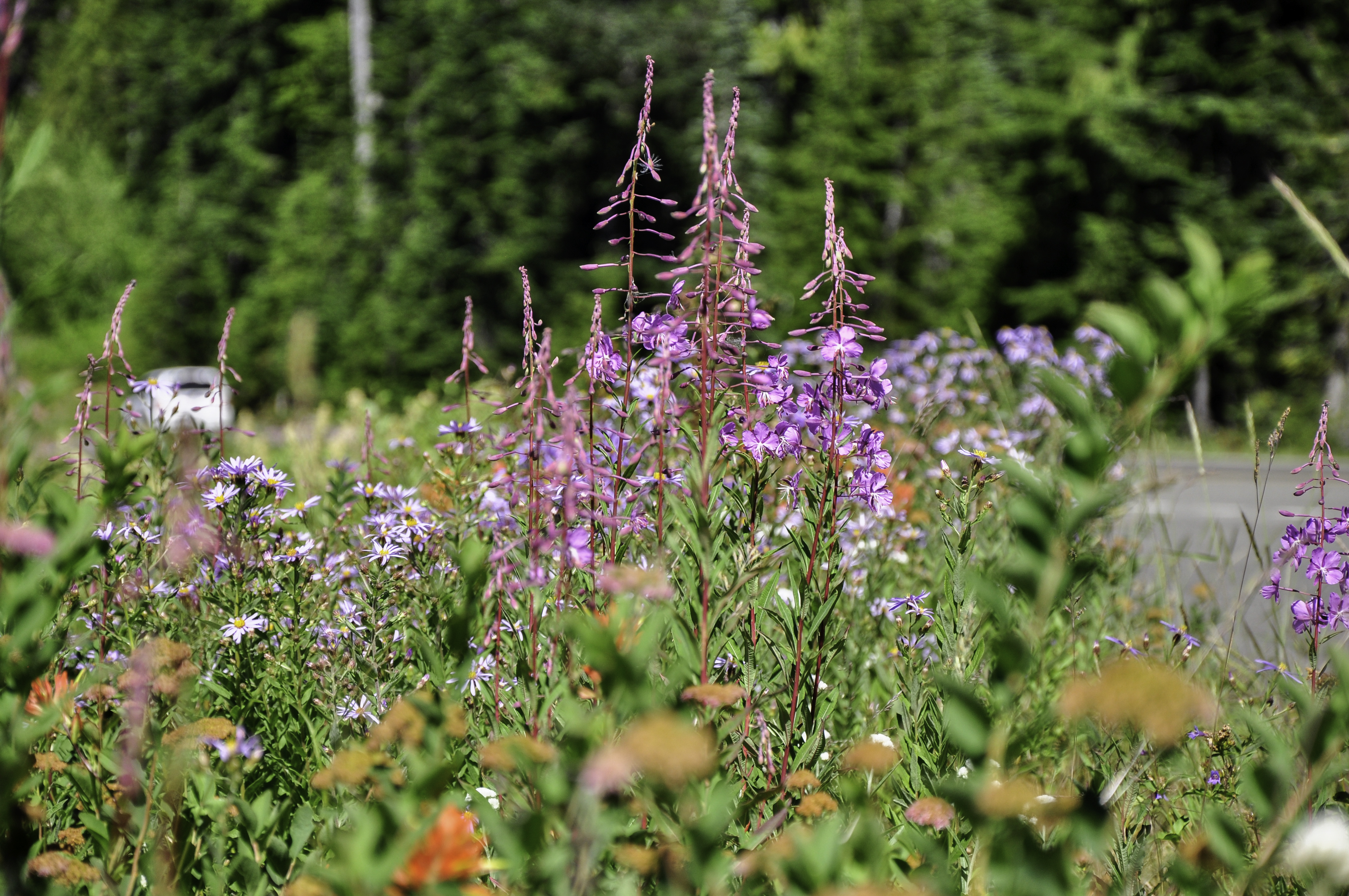
And the wildflowers were in full bloom.
We easily found a campsite outside the Park boundary, and the next day we went back to Rainier for round 2. This time we arrived early (okay, well, early-ish) to snag a parking spot at Sunrise. While this parking lot offers some stunning views of Mt Rainier, there are also several hiking trails that start here.
We hiked a total of 6 miles in a loop, passing Frozen Lake along the way to trails called Burroughs 1 and Burroughs 2.
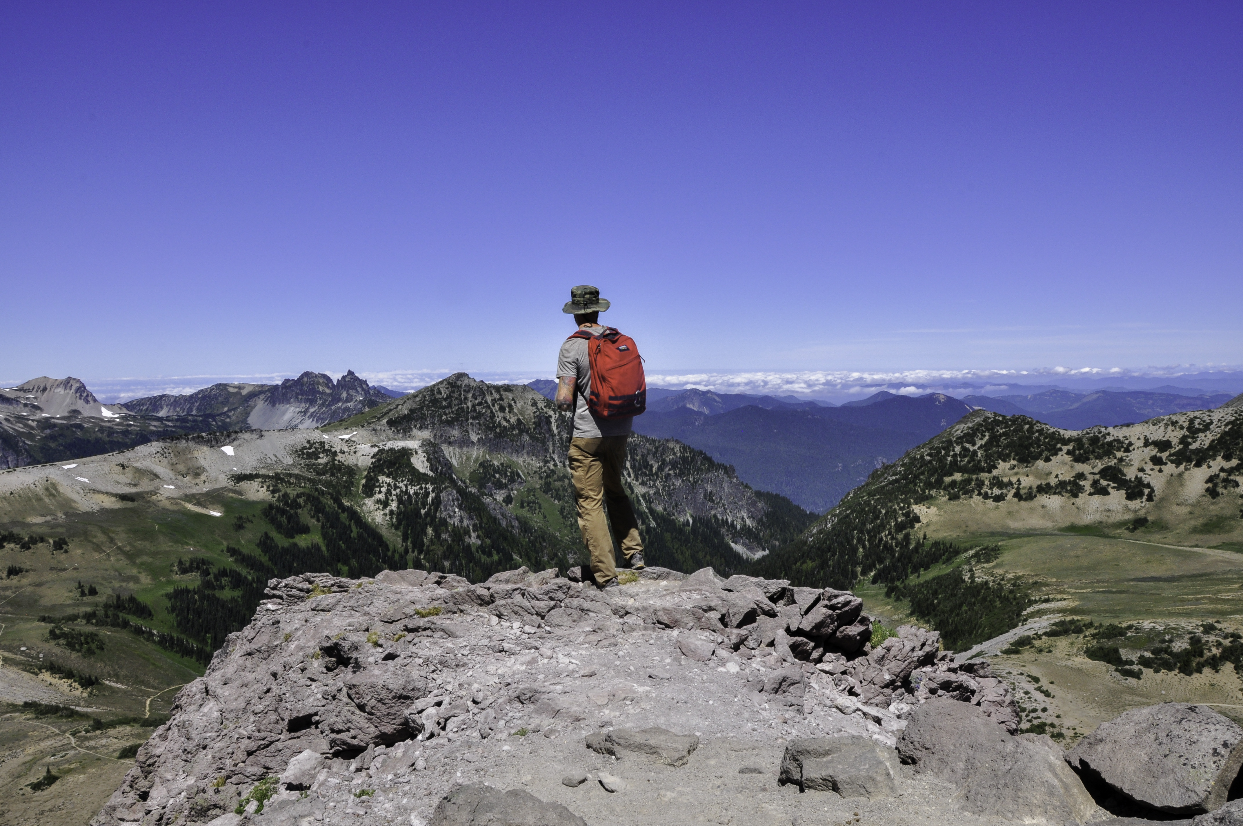
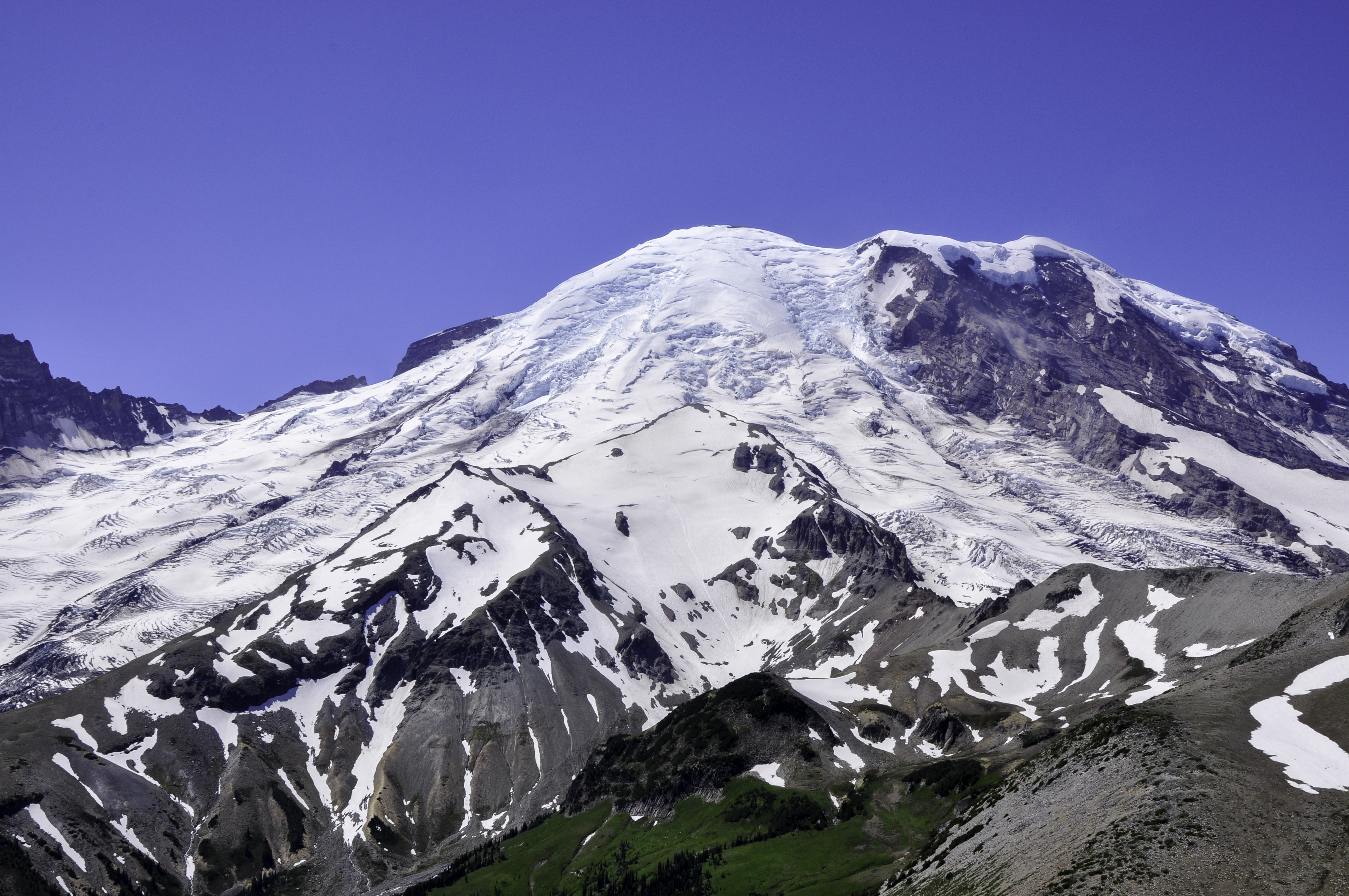
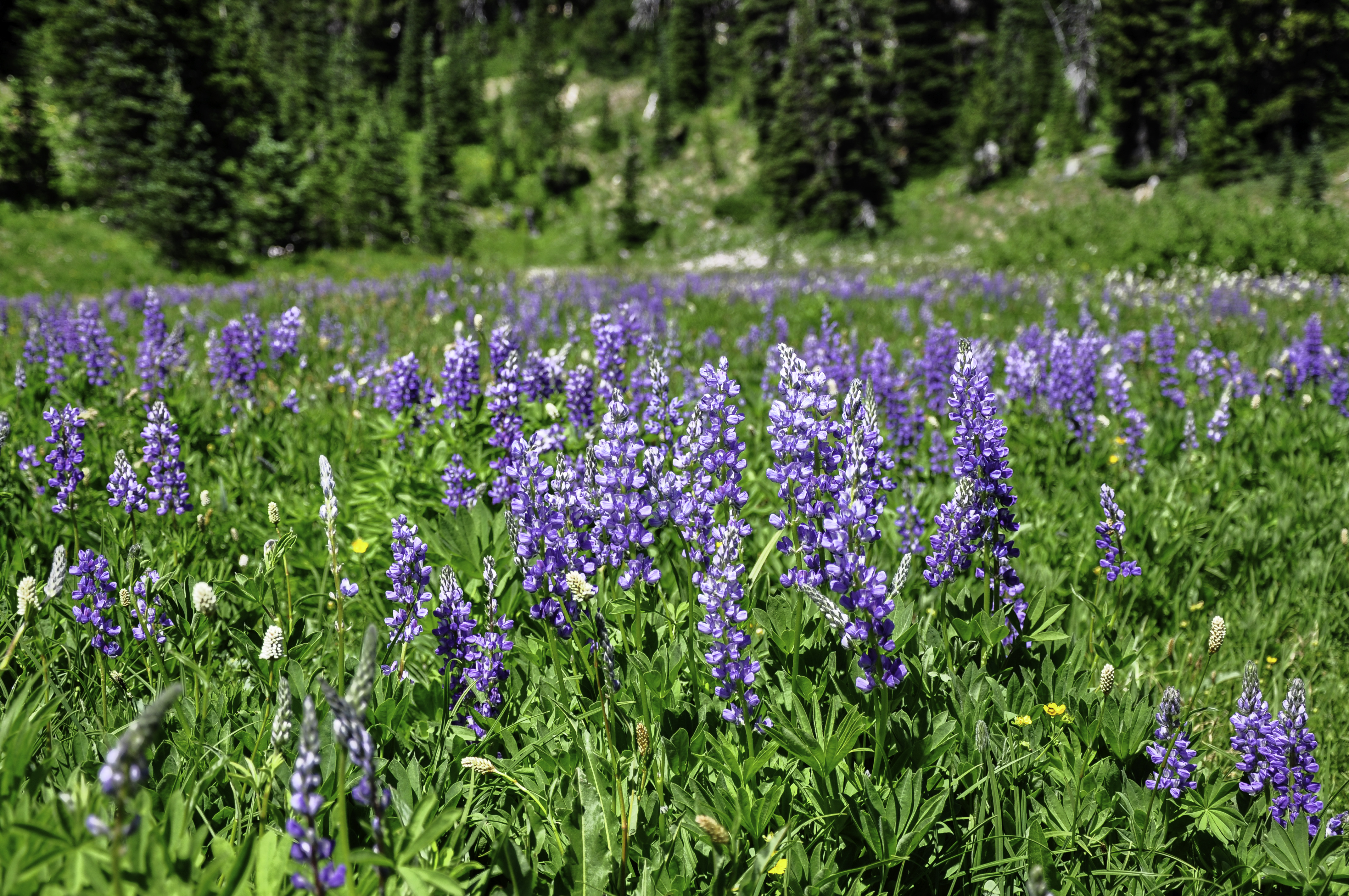
After a snack, taking in the views of Mt Rainier, we headed back via Shadow Lake. I never saw so much Lupine in my life.
Super glad we decided to go visit Mt. Rainier National Park.
Comments
One response to “Mount Saint Helens National Monument and Mount Rainier National Park”
With thanks! Valuable information!