First, I want to thank all of you for the kind words, both here on the blog and on Facebook, for the tribute to Elvis on my last post. You’re all so thoughtful and your comments mean the world to me and to Michael.
With Michael’s parents in a bit of a holding pattern, we decided to hang out in San Luis Obispo for a bit longer. But I really, really wanted to get to Yosemite before Memorial Day. Everything that I’ve read, every person I’ve talked to about it, they’ve all said summer is the high season in Yosemite Valley, and that the traffic is miserable.
So we made plans. Parts of it were tough – setting aside the extra leash and food bowl – but Bailey is up for anything, and he was ready to go. We drove out from SLO towards Fresno, then made our way up Highway 41 towards Fish Camp.
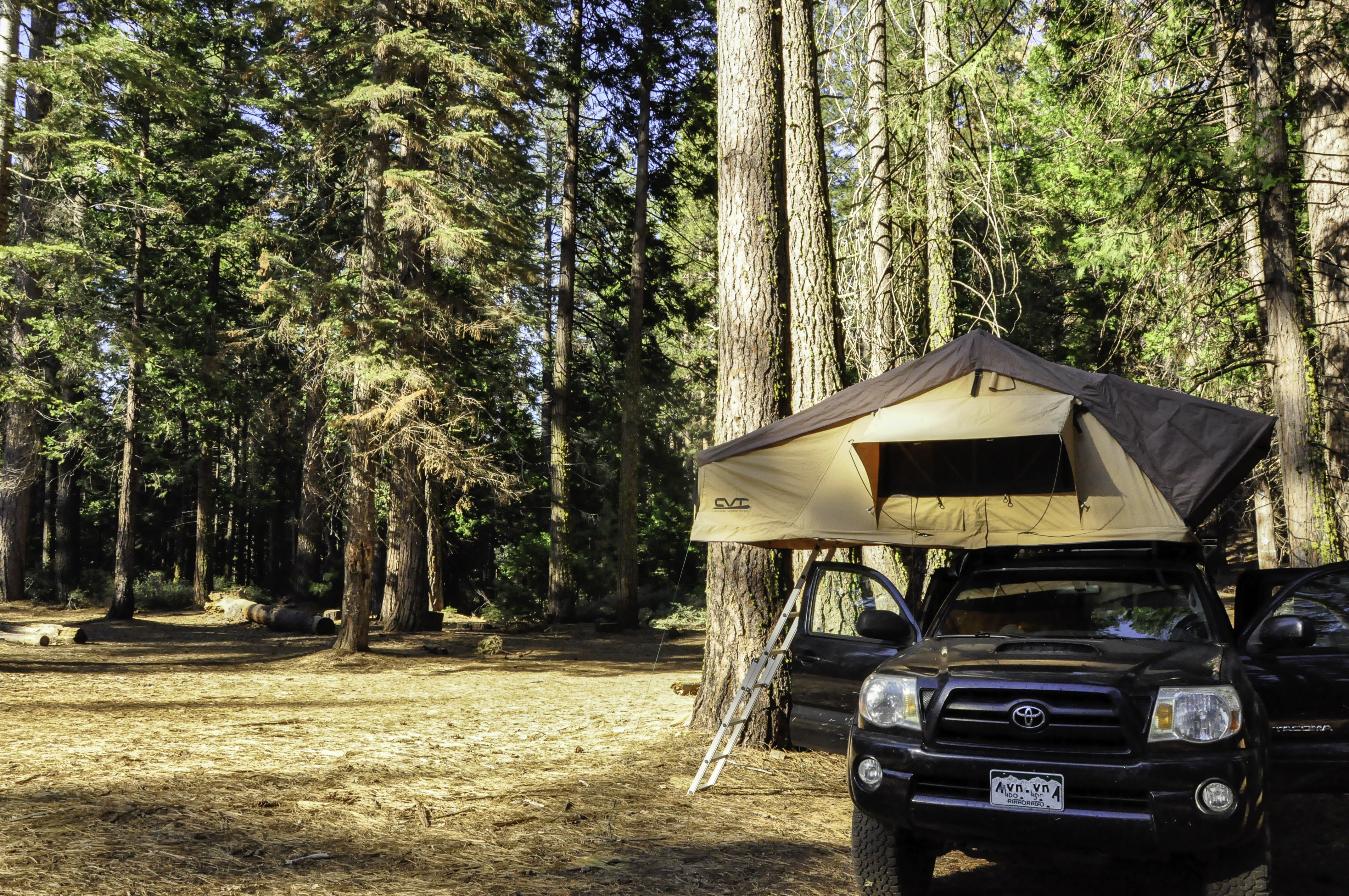
Just outside the Park boundary is a place called Goat Meadow Snow Play Mountain, which does not contain any of those things, but was still a free place to camp. Hardest part was finding a remotely level spot that was not directly underneath a dead tree. (Pine beetles are devastating the trees out here, just like they are in Colorado.) Eventually we found a site we felt we could live with.
I read that Goat Meadow is about an hour from Yosemite Valley. We headed out around 9am, having no idea what to expect, other than a pretty drive. We were not disappointed in that regard. Then, we came around a turn and there was a big pullout on the right side of the road. We pulled over to check it out.

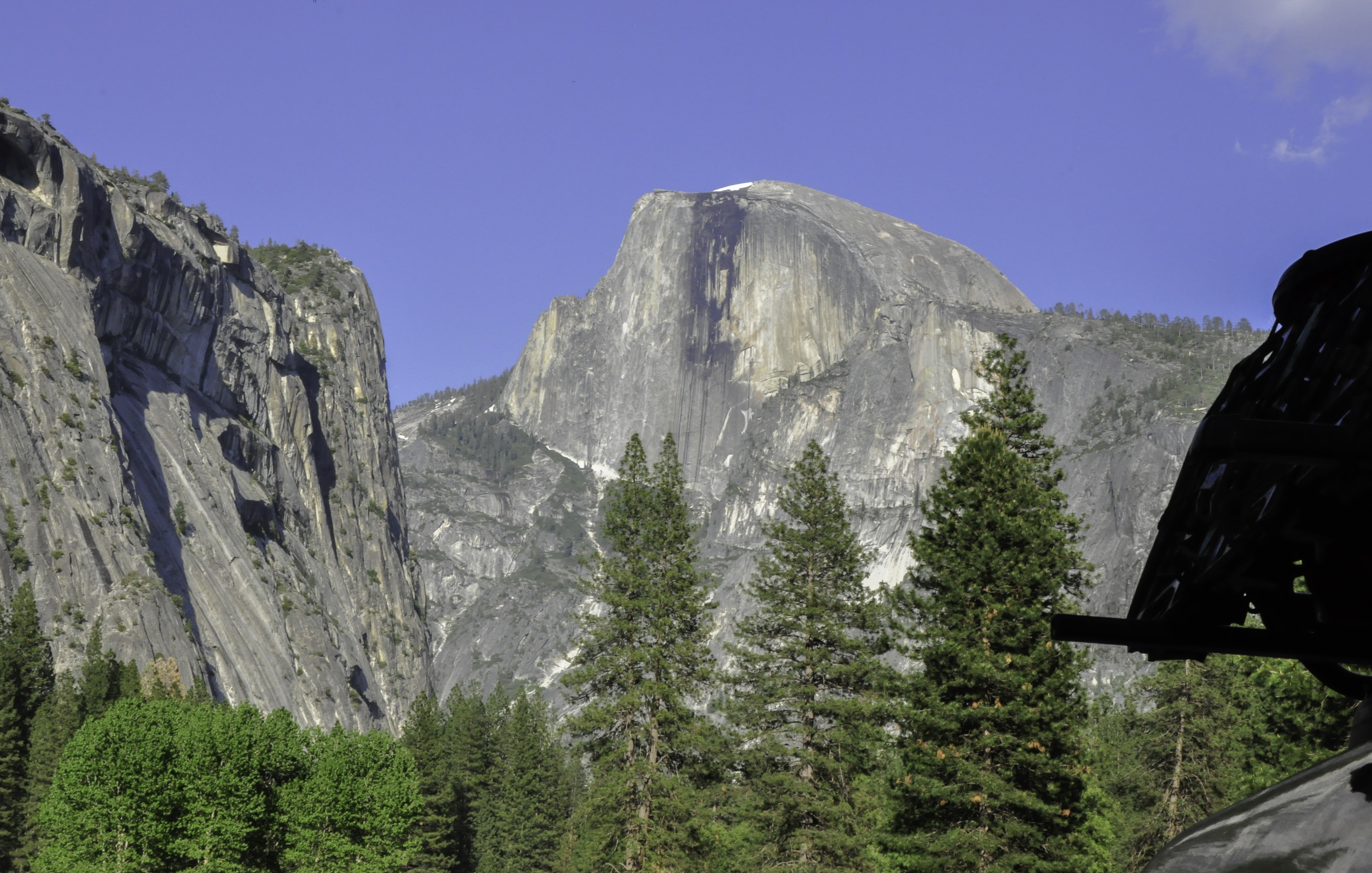
I’m pretty sure I squealed like a little girl: that was Half Dome! I’d been seeing that gorgeous rock formation in pictures for so many years. Finally, I was seeing it in person. Oddly enough – this would be pretty much the last time I saw Half Dome that day. More on that later.
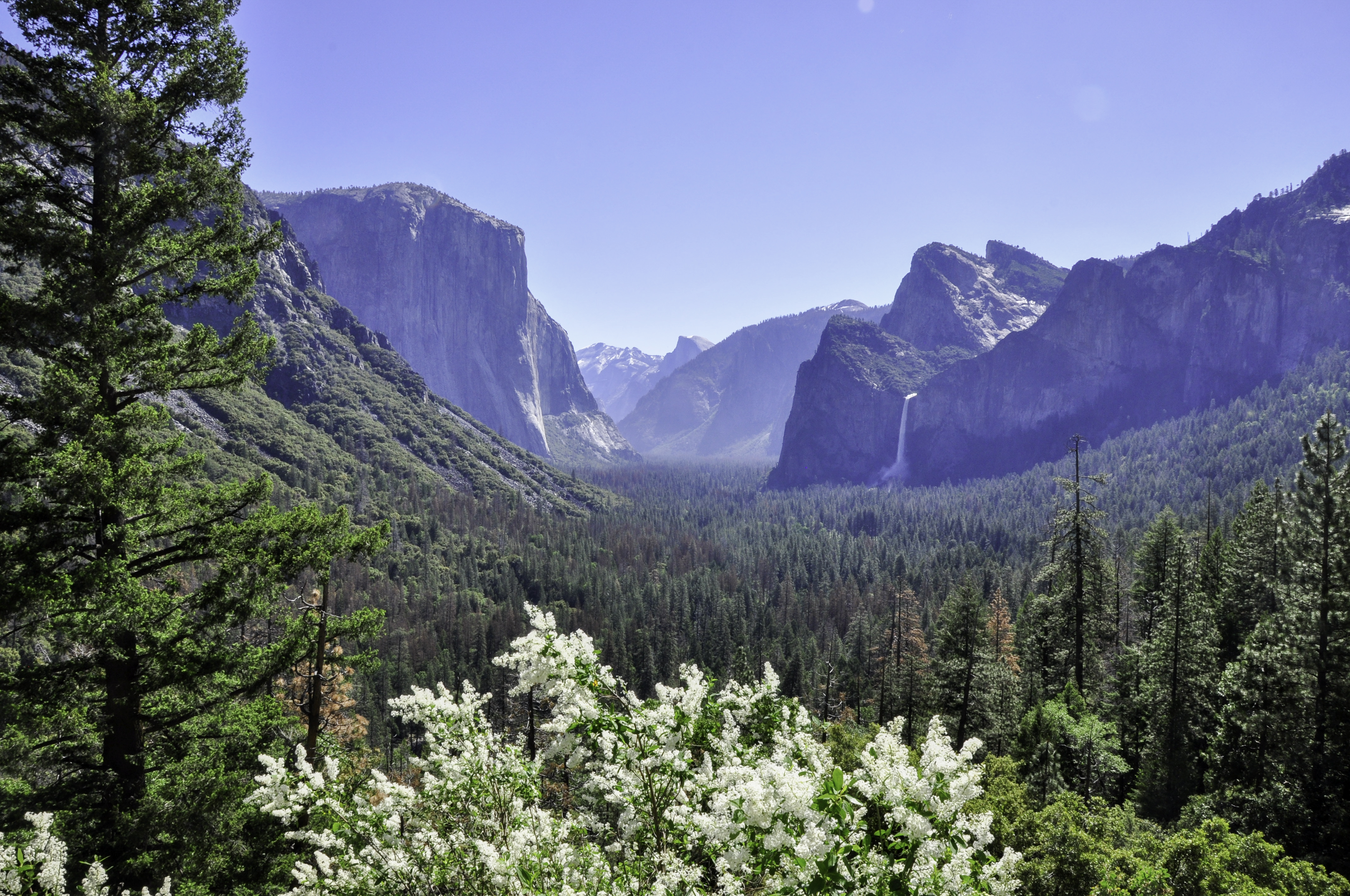
The next viewing area was just past a tunnel, and called (appropriately enough) Tunnel View Point. I made this picture small – Tunnel View Point looks best in the afternoon sun, and that picture is coming. On the left side of the valley is El Capitan, and on the right is Bridalveil Falls.
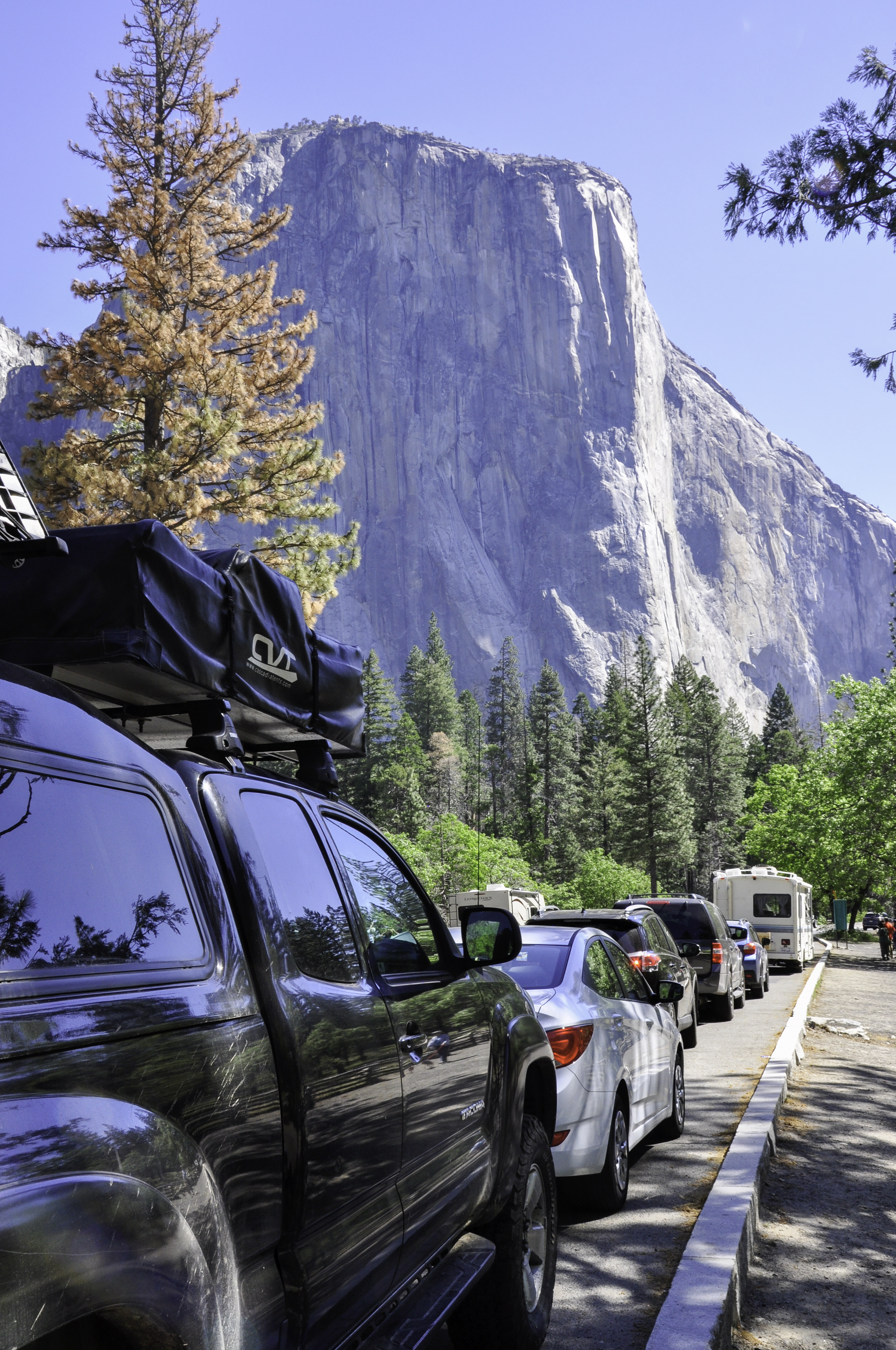
Parking was still plentiful so Bridalveil Falls was our next stop. This area also gave me a great photo opportunity – Taco Negro with El Capitan.
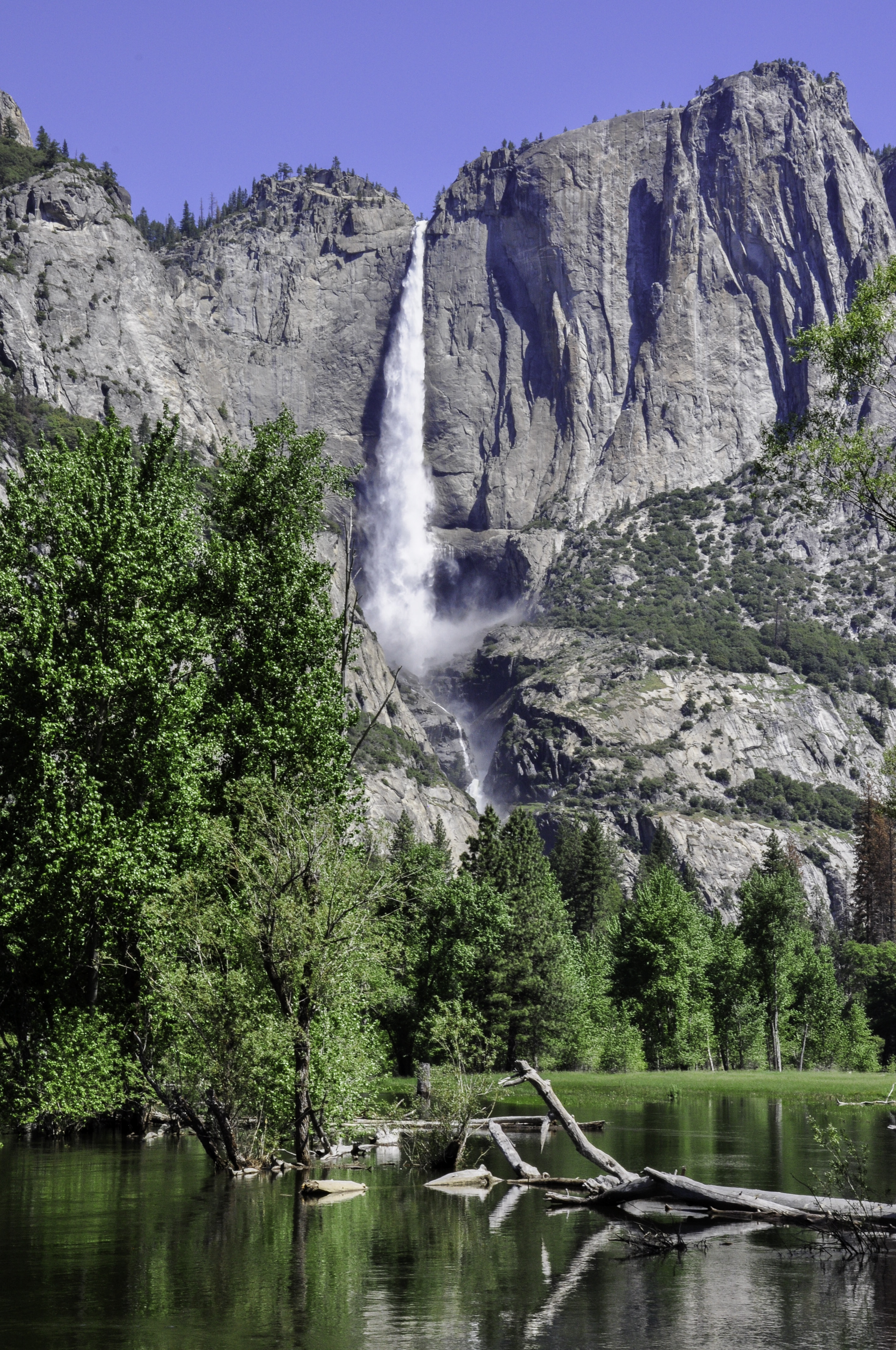
I’ve mentioned before that the snowpack in the Sierras was at 170% of normal this winter, and that means that the waterfalls in the Park were raging.
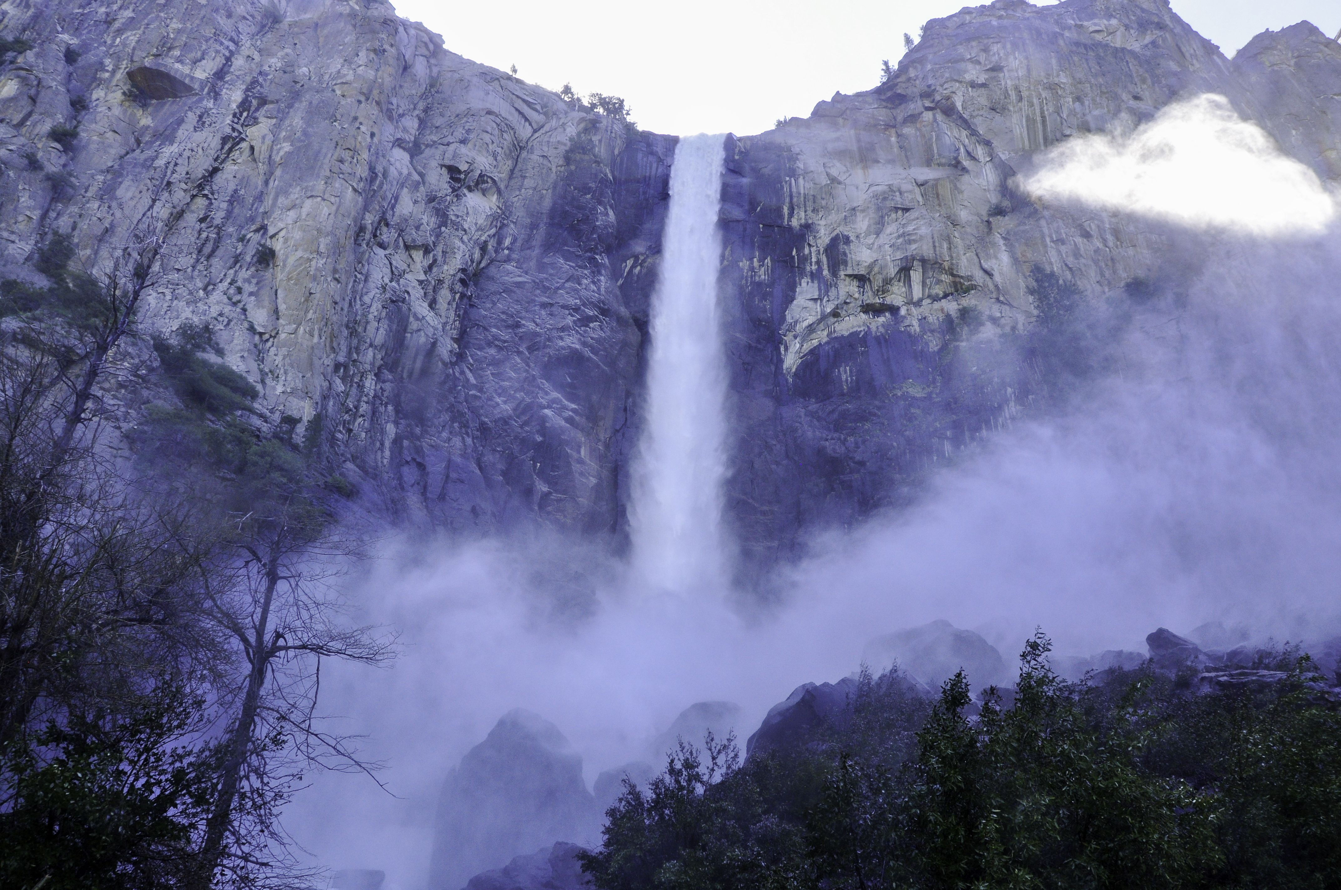
We actually walked up to the end of the path, which was was covered in about an inch of running water. I brought my camera and took a few photos, but none of them turned out all that well – the lens kept getting covered with mist. Bridalveil Falls was raging.
Moving on. In a sign of things to come, parking at the Swinging Bridge area was tight. We only got a spot because somebody was leaving right as we pulled in.
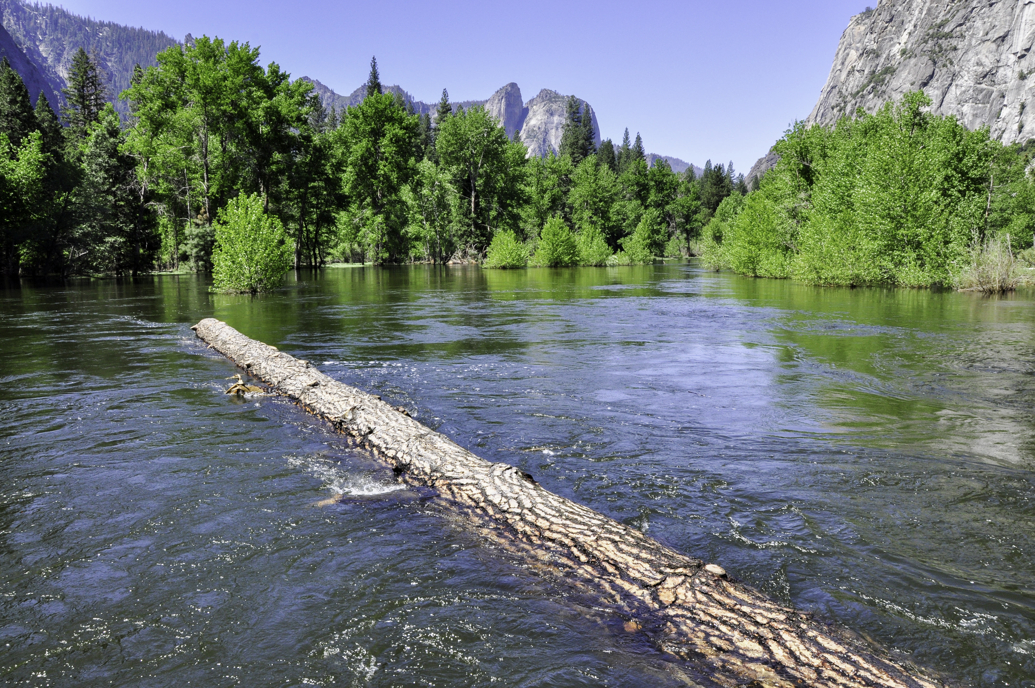
This gigantic log is trapped underneath the bridge by its root system. That’s how high the water is on the Merced River! The view from the other side of the bridge was pretty nice, too.
That’s Yosemite Falls, both upper and lower, although it’s hard to see the lower part. I moved along the river for a bit for a better (although that’s a pretty relative term) view.
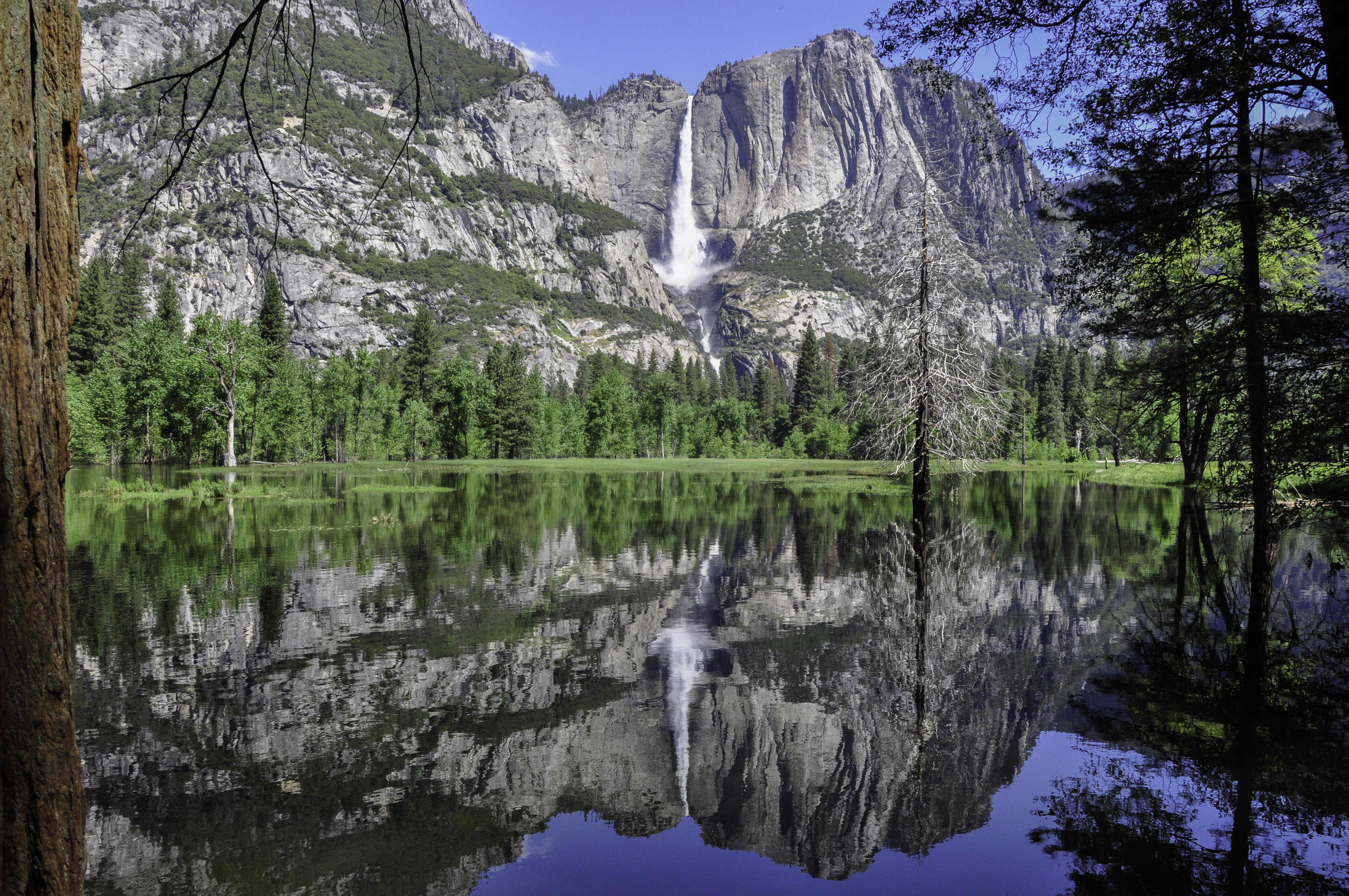
I think I have about a dozen images of Yosemite Falls… from this location alone.
Eventually we did move on. And then the “fun with construction” began. Our first day in the Park, Sentinel Bridge was closed so we were forced over towards Half Dome Village. We found a place to park. In a lot that had about a dozen of these yellow signs warning you to NOT leave food in your car. Use the bear vaults.
Okay, but we didn’t see any bear vaults. And there was no way to get all the food out of Taco Negro. We had lunch to think about it, which was not all that fun because the smell of garbage was pretty potent in that little spot.
We didn’t want to find out the hard way that you really shouldn’t leave food in your car, so we set off to find a better spot.
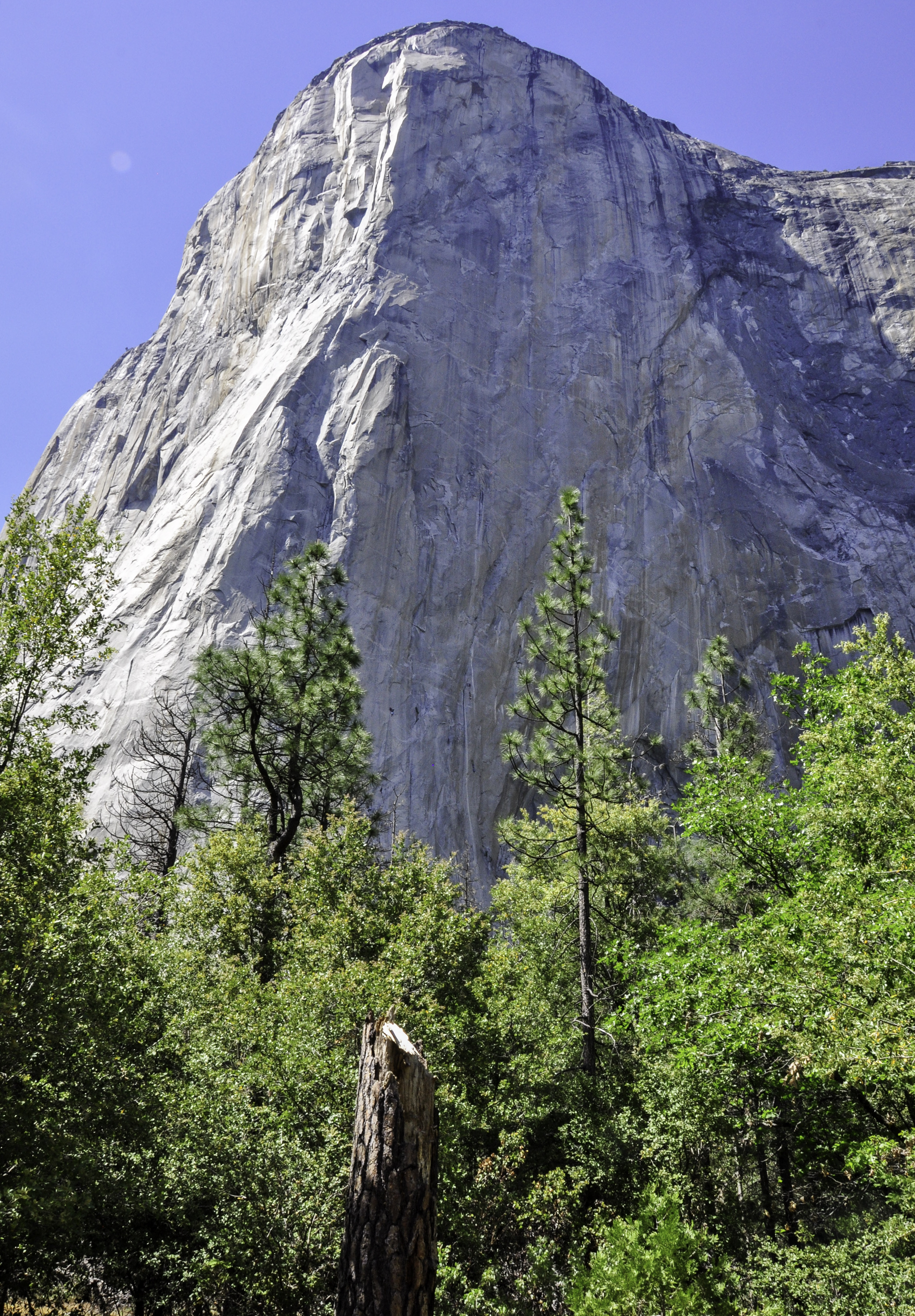
Big mistake. We drove about 5-10 mph in bumper-to-bumper traffic all the way around the valley. Every parking lot we passed was full. Eventually we got past Yosemite Village and things started to thin out a bit. We parked at the El Capitan trailhead and took a walk to the base of this 3,000 foot rock.
We saw some climbers on the shaded side, which gave me an opportunity to use my new 70-200mm zoom lens:
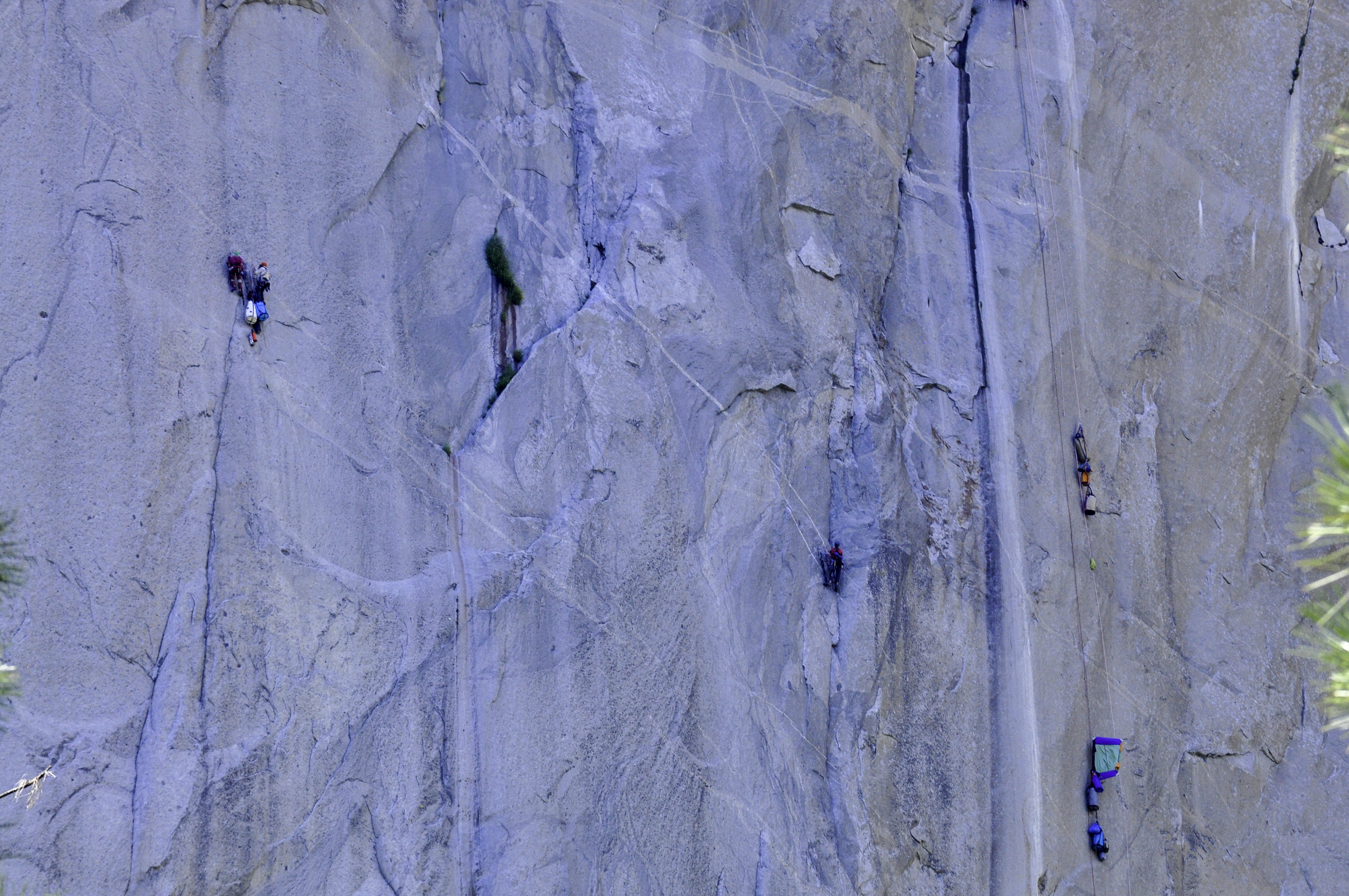
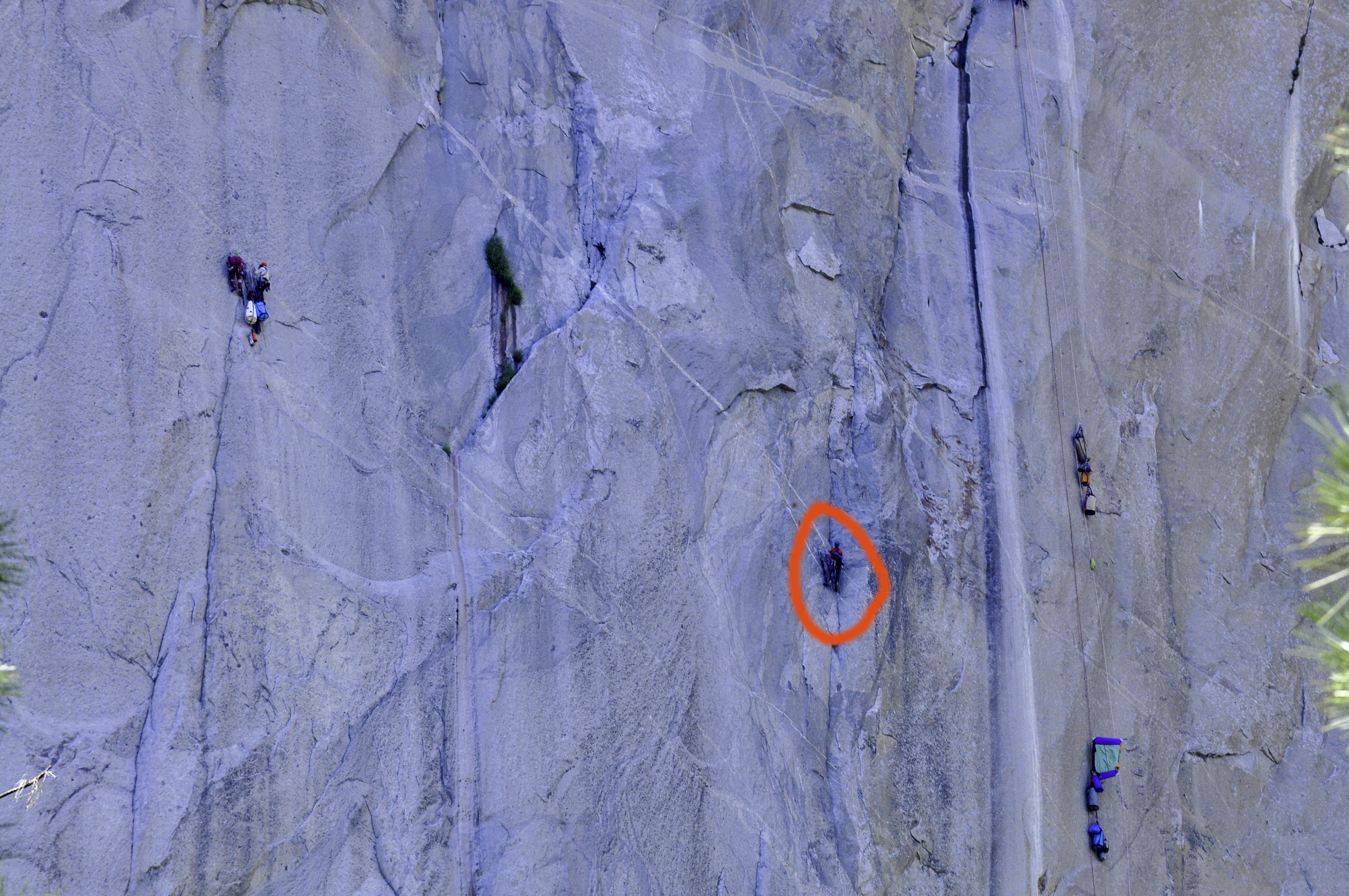
At first, I couldn’t make out the climber at all. Michael pointed him out to me. But he couldn’t be out there all by himself – what were all those haul bags for?
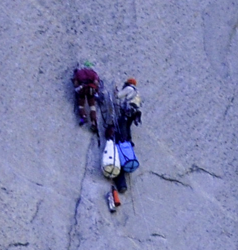
But when I edited these photos, I was able to zoom in even more. There are actually two more climbers on the left side of the photo.
When we got back to the truck it was 4pm. Were things winding down in Yosemite Village? That’s kind of how things worked in Yellowstone (which we visited in August – the height of the tourist season). We had the option of leaving the park, or turning left and going back through the loop of Yosemite Valley.
We went left. And about 30 seconds later ( 25 seconds past the point at which we could still have corrected things) we realized our mistake.
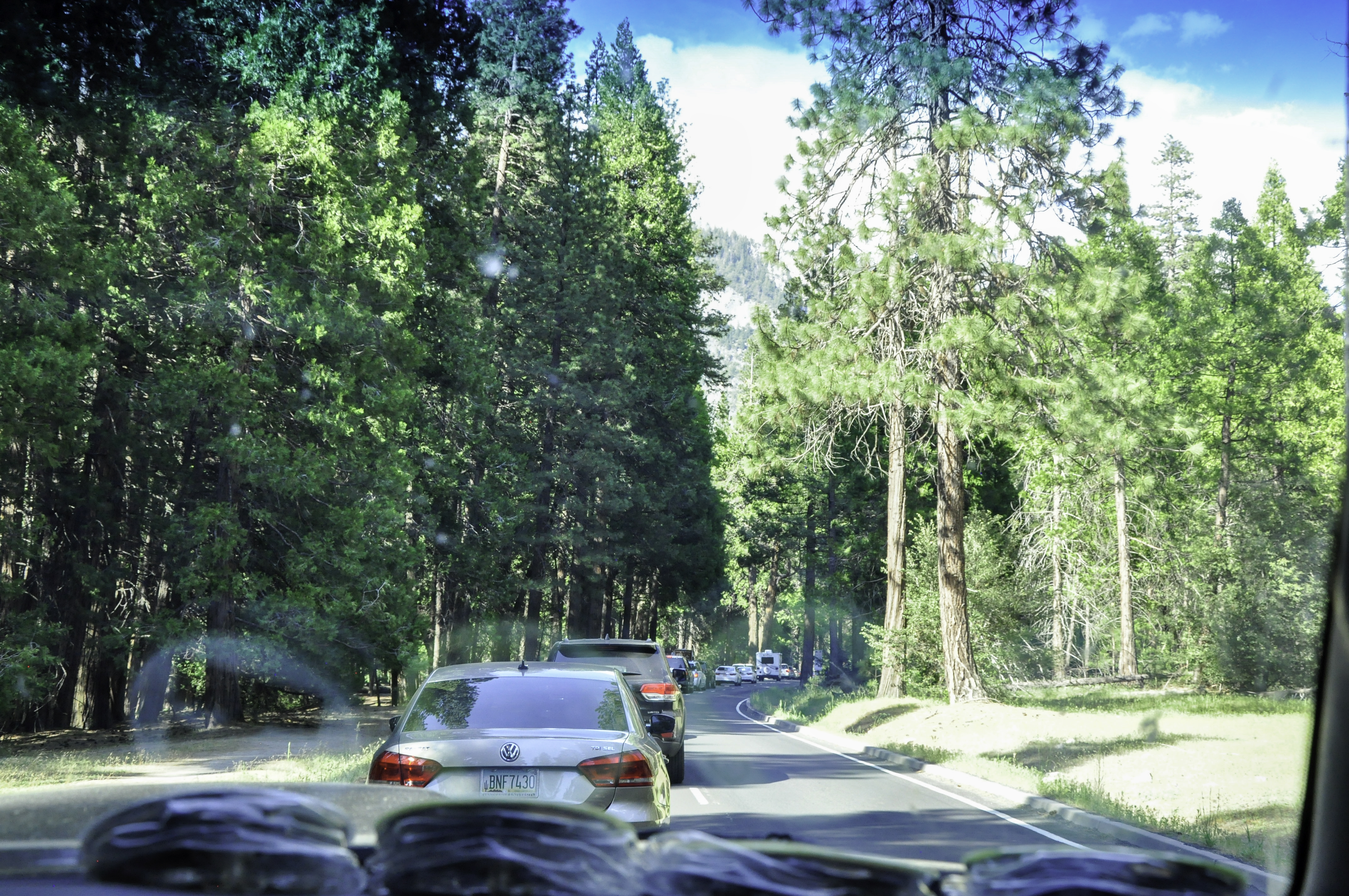
It took us two hours to drive the Yosemite Valley loop. Well, I was just the passenger. Michael was driving, so direct all your sympathy to him. This was a one-way road with no exits – believe me, we looked. And every parking lot was still full. We drove so slowly that sometimes we weren’t even moving. Michael just shut the truck off. When we eventually made our way back west, I saw some people walking who stopped to take pictures. What were they looking at? I twisted in my seat.
It was Half Dome. I grabbed my camera, leaned way out of the window, and took this picture:
When we arrived alongside Yosemite Falls, there were parking spots available, but now it was 6pm. I wanted to get back to Tunnel View Point, and Michael obliged.
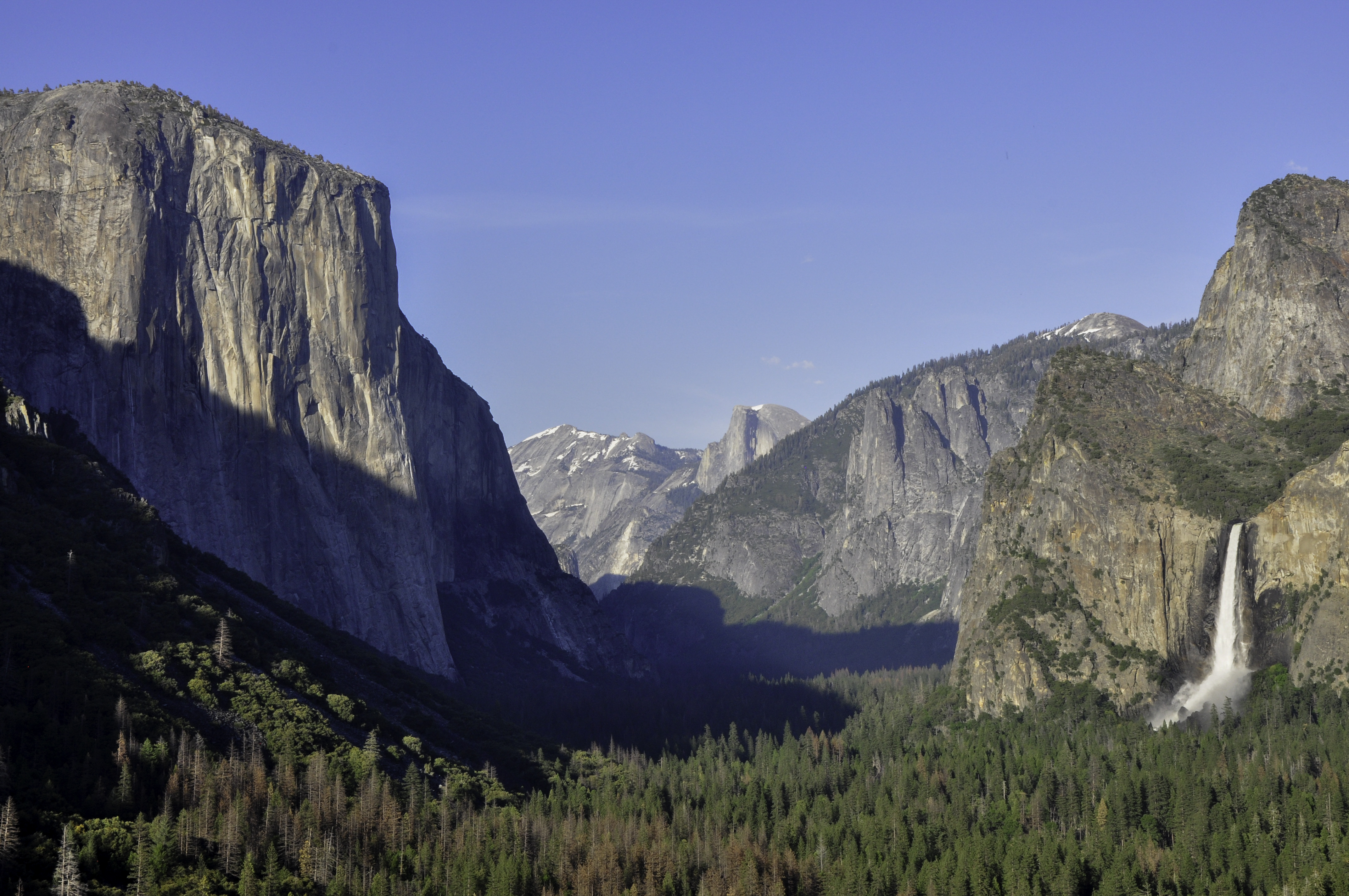
Sunset it definitely the best time to stand at Tunnel View Point. The Yosemite Valley really is magical, if you can look past the traffic. We were not done with this area yet. But we knew, going back the next day, that we had to have a plan.
Next post: The Plan.
Comments
4 responses to “Yosemite National Park”
WOW!!! What great pictures. Keep them coming, daughter.
We would love to go there, but not with that traffic. Maybe pictures and videos will have to be our “visit” to that area.
They actually offer tours and tour buses – you could go without driving, and stay in one of the hotels right there in the Park.
Happy you got to experience Yosemite. Great pictures, too.