I had such high hopes for our trip to Canada. I’ve wanted to see the Canadian Rockies for something close to forever. Kind of since I learned of their existence. And on that front, I can’t say I was entirely disappointed.
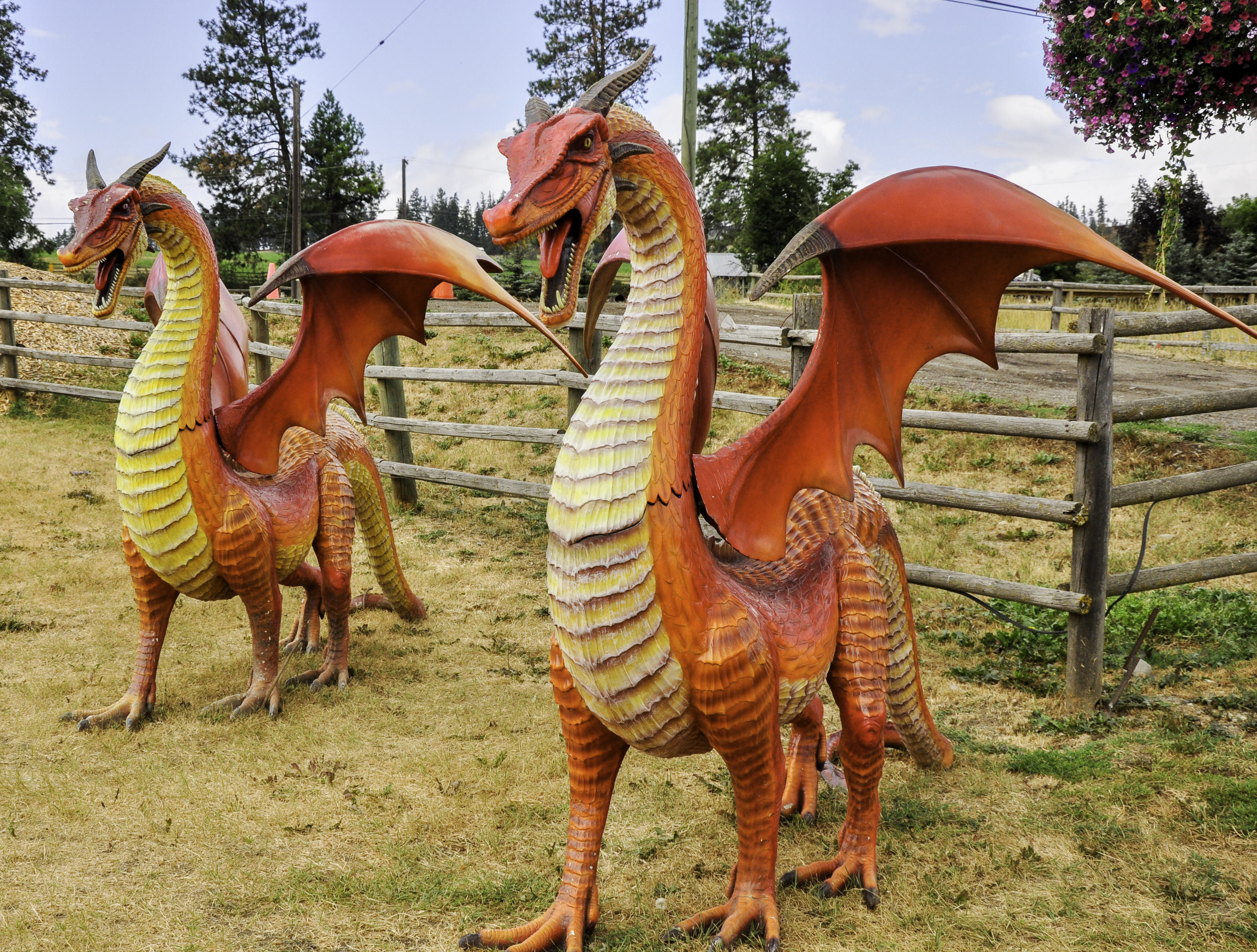
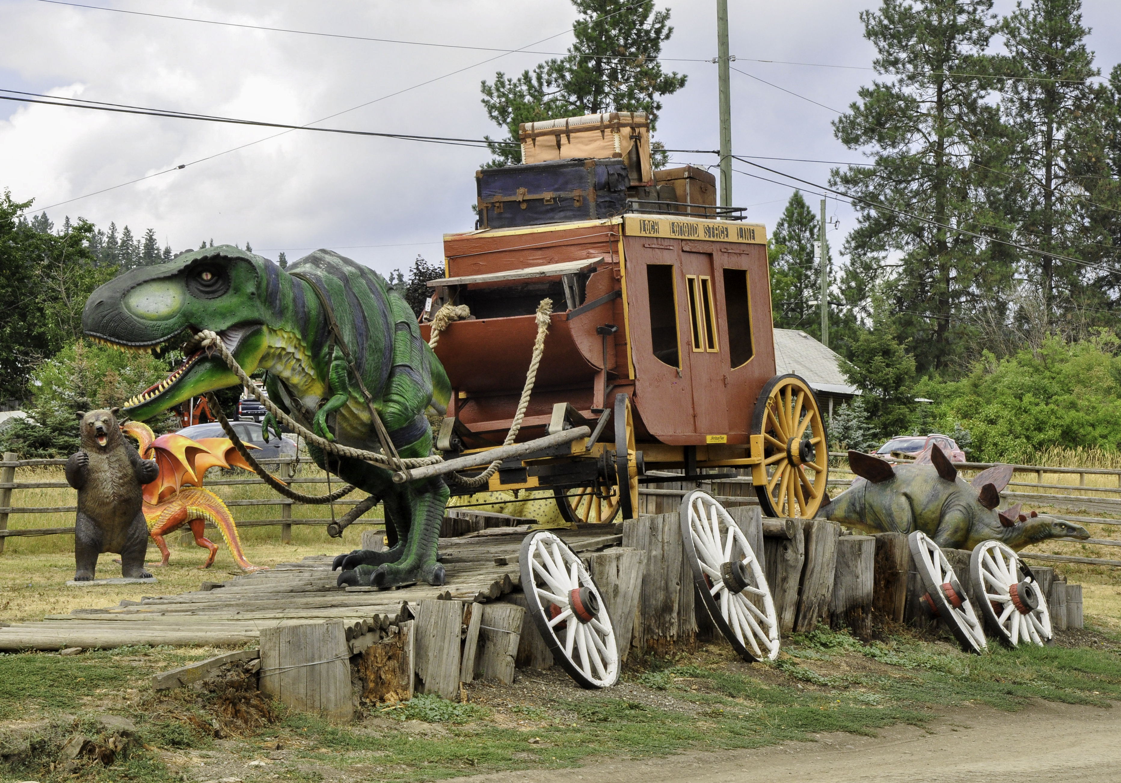
We drove from our campsite near Westwold, British Columbia and headed towards Banff, skipping western BC because of all the fires there. Then we headed north on Highway 97A so that we could get back onto the Trans-Canada Highway. Suddenly, there were dragons on the side of the road.
What the what?
Michael pulled into this (fairly full) parking lot while I tried to figure out where the hell we were.
Turns out we were at the Log Barn.
Described as “the most expensive tourist trap in British Columbia” by someone on TripAdvisor, the Log Barn is an…um… eclectic mix of dragons, dinosaurs, goats, and food. Expensive food. Luckily we carry our own supplies so we had a nice tailgate lunch instead.
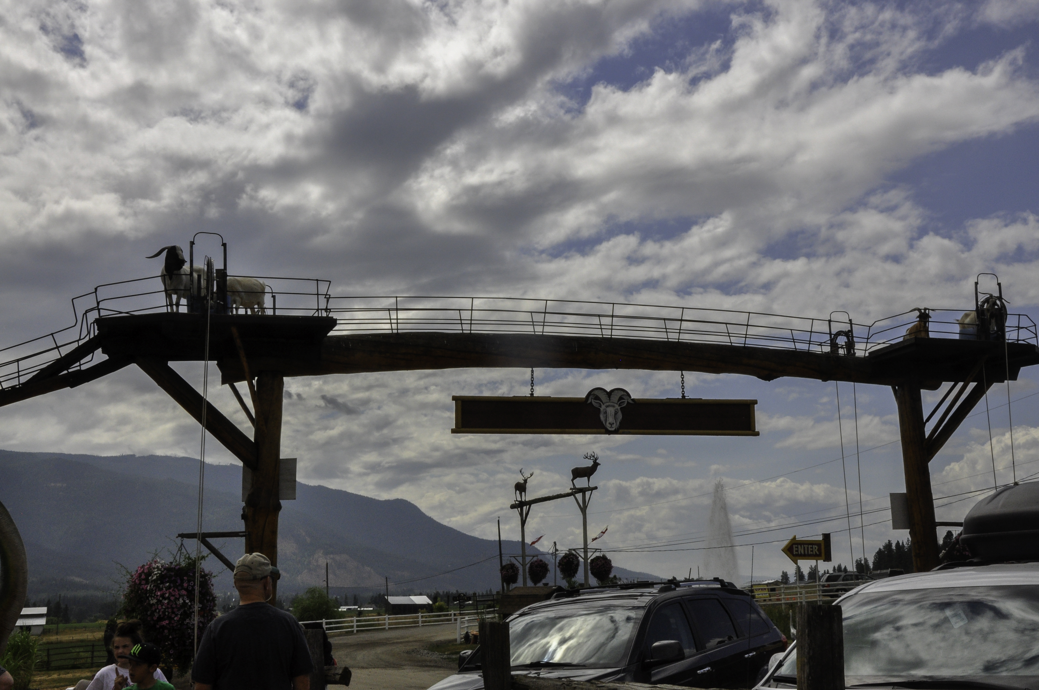
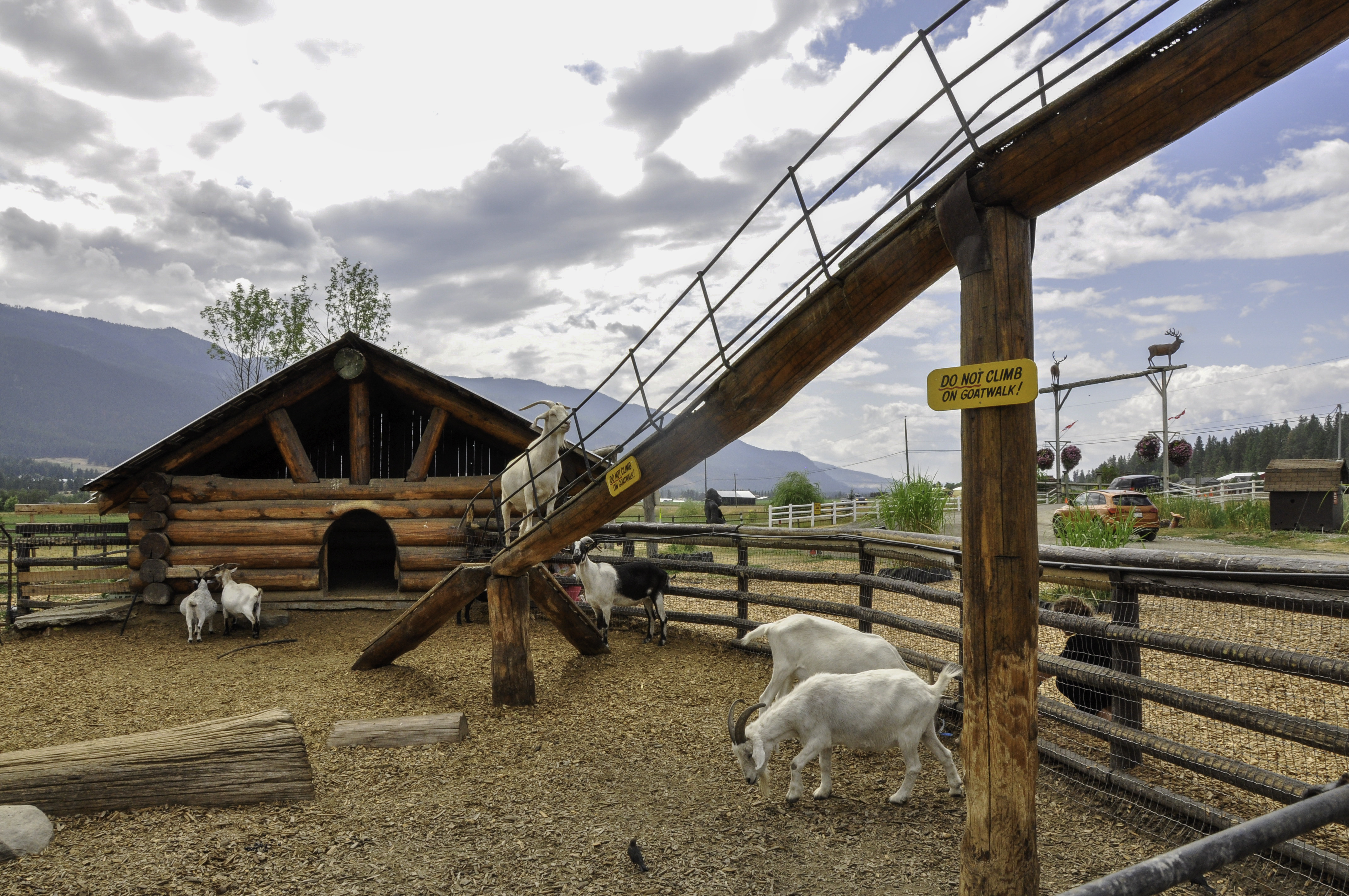
This is a bad picture of the “goat walk,” which you have to drive under just to get into the Log Barn. (You can buy feed for the goats for a quarter.)
The goats have a regular pen and access the goat walk via this runway.
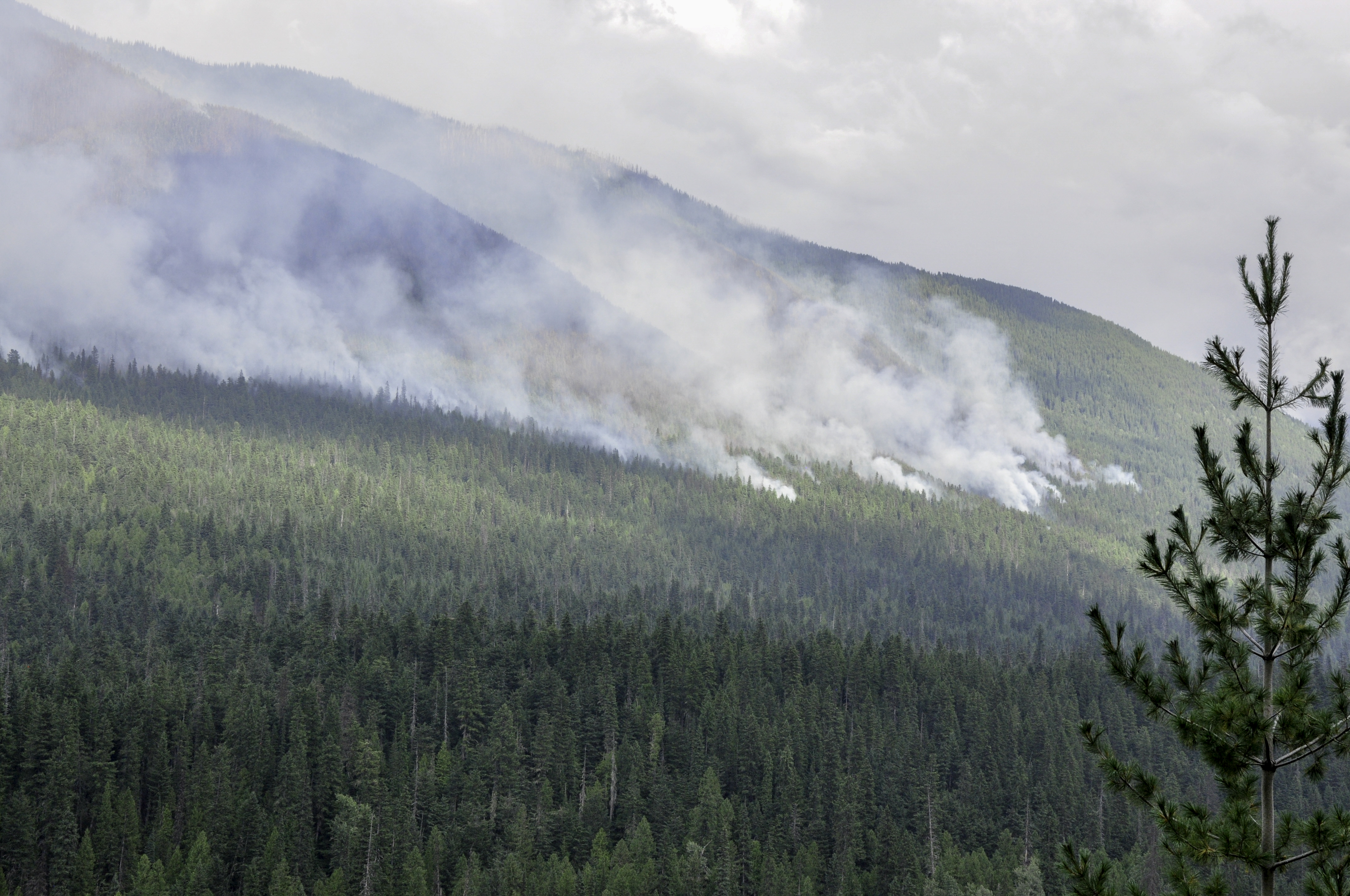
Moving on (and keeping our money in our wallets), we soon discovered that the Canadian fires were not restricted to western BC. The Canadian Rockies were on fire, too.
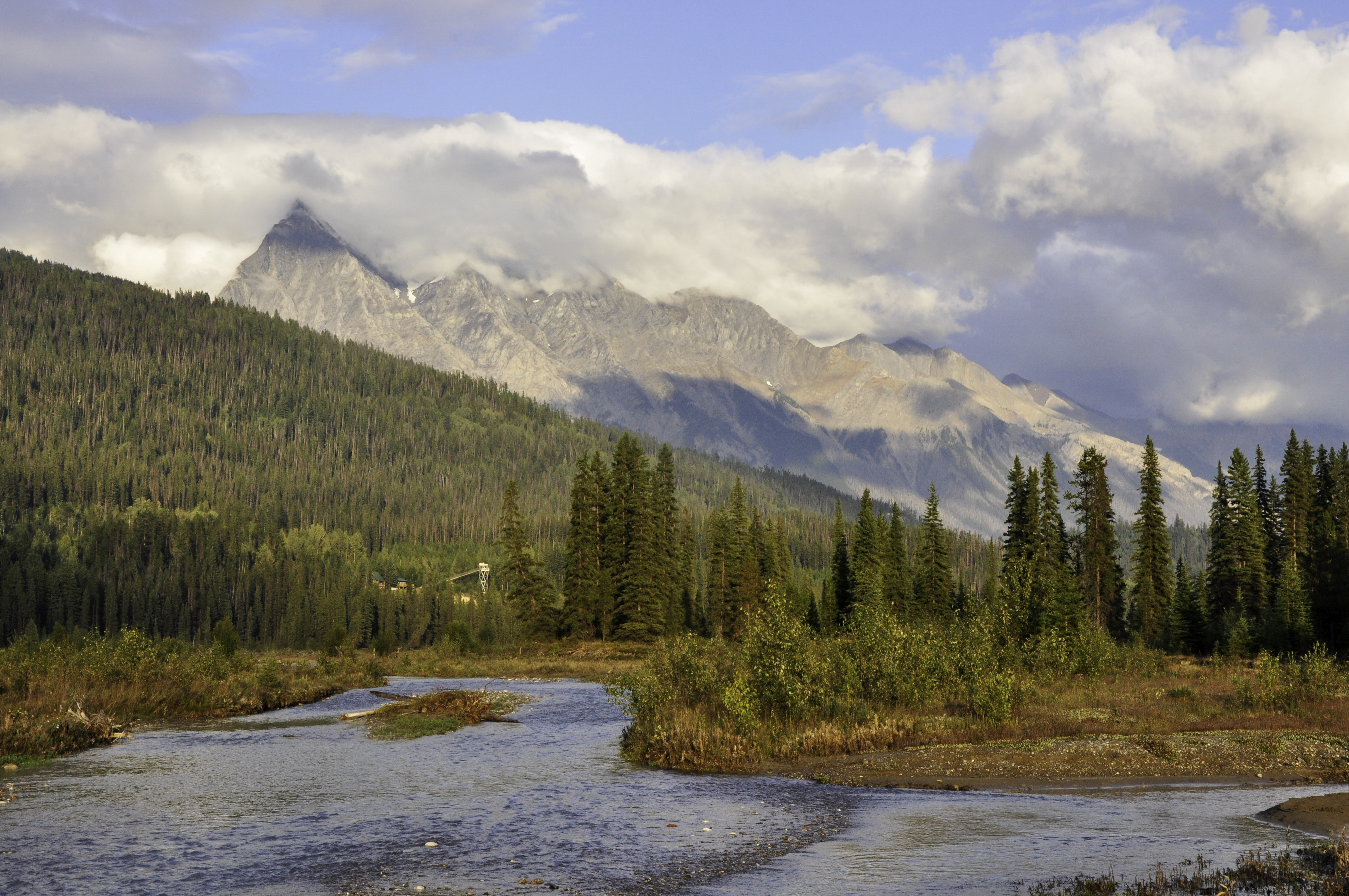
We camped that night along the Kicking Horse River, just west of Golden, BC. This was a sweet little spot with a nice sunset view.
It rained overnight. In the morning I was about halfway through making coffee when the skies opened up on me. I finished making coffee in the rain and then stood underneath the tent, drinking my well-earned java. Michael popped his head out of the tent.
You could bring that upstairs, he said, and have coffee in bed.
He was delighted to learn I’d made coffee for him, too.
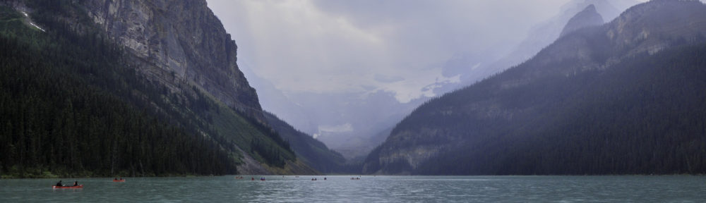
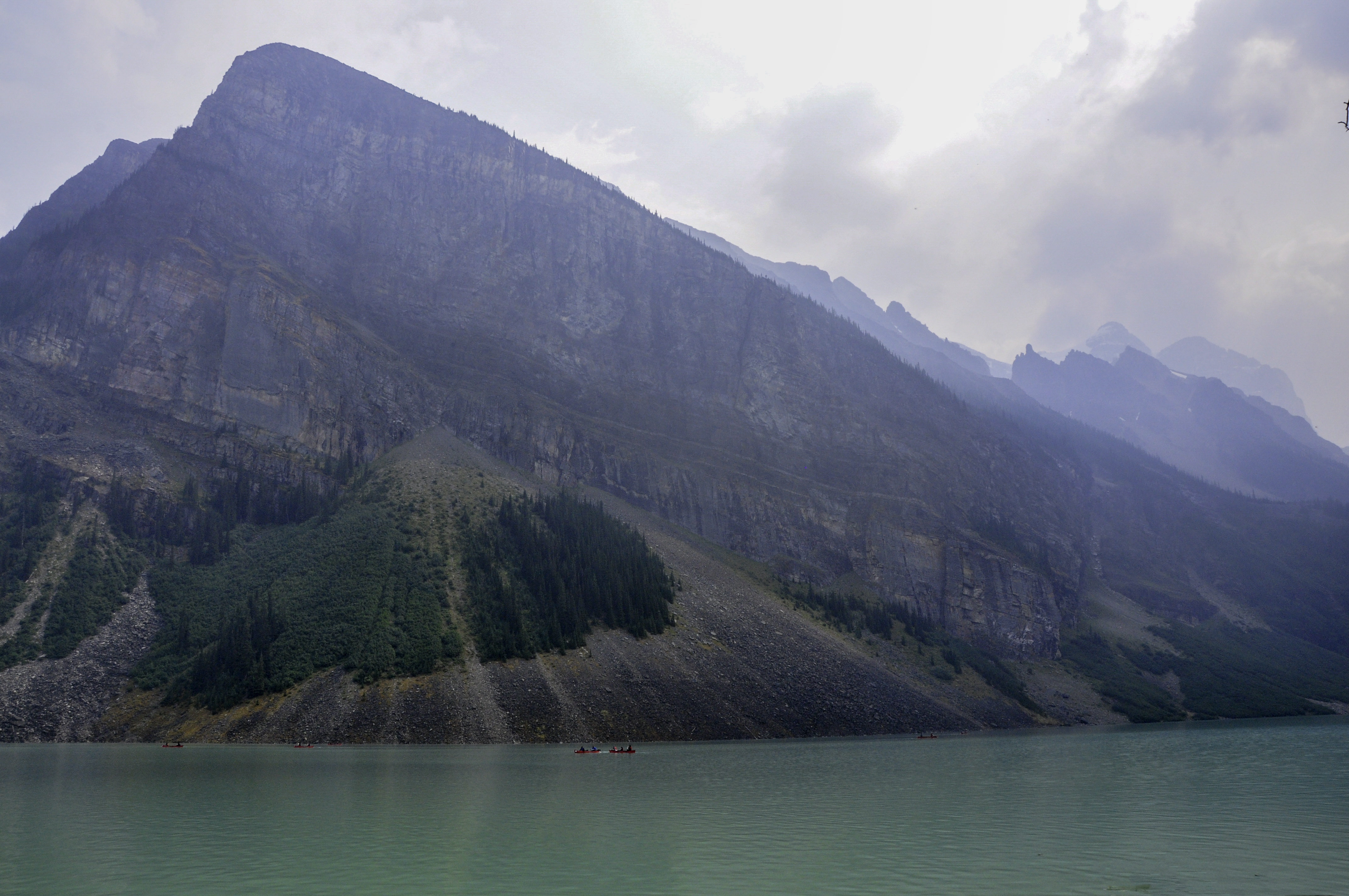
After the weather cleared we moved on to Banff, and places I’d long wanted to photograph, like Lake Louise and Moraine Lake. I’d hoped that the rain would help with the wildfires but the smoke was still pretty thick.
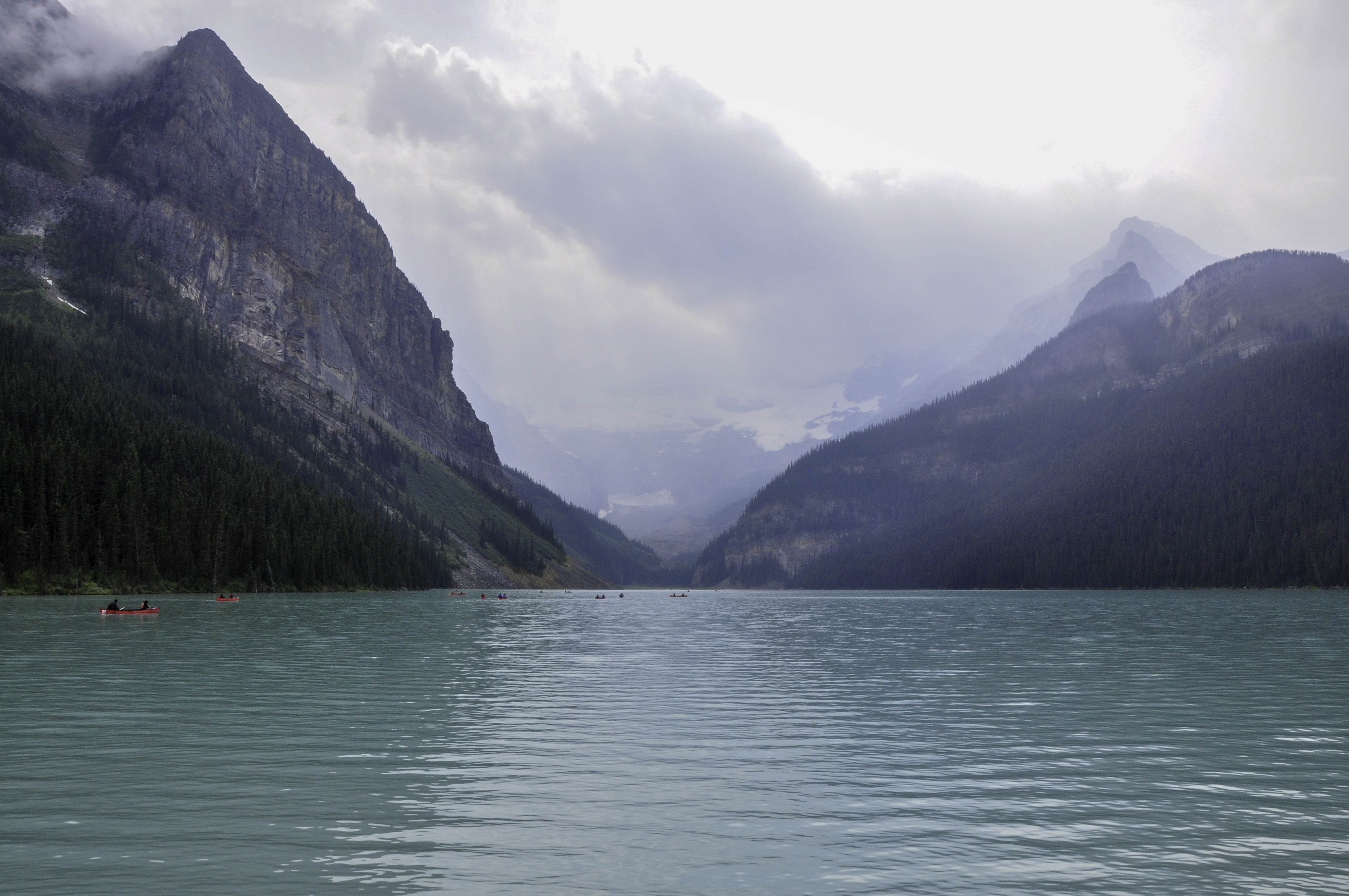
Also, did you know that there is a massive hotel on Lake Lousie? I mean, right on the shore. This area was about as jammed with people as Yellowstone. We checked into renting a canoe, since that looked like fun. It cost $105 (Canadian) per hour to rent a canoe.
Apparently the Log Barn isn’t the only tourist trap in Canada.
I tried to find other interesting images, since the “classic” view of the lake was a no-go.
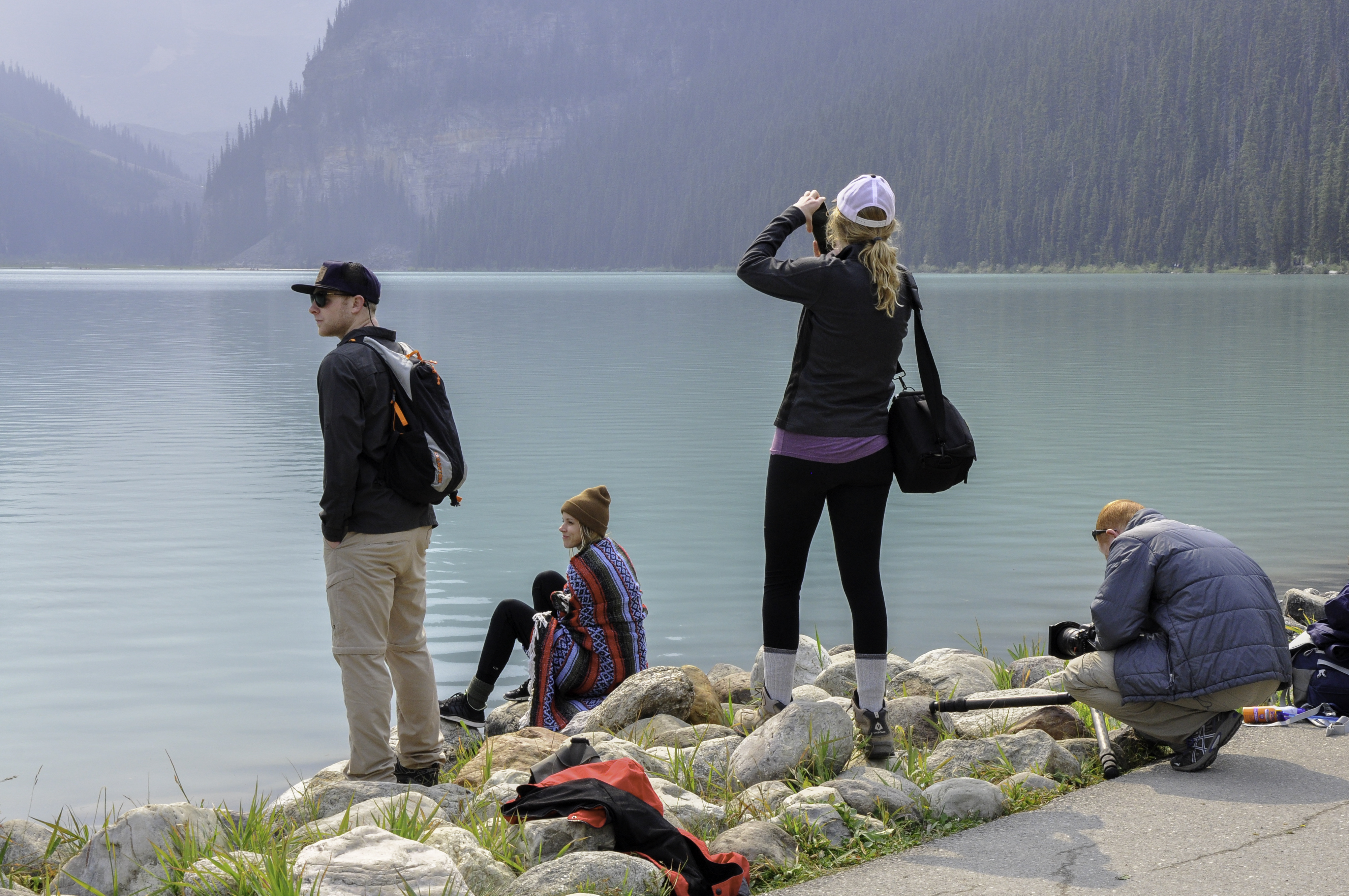
I also took a short hike along the shoreline. I found what I called the “Instagram Girls,” who were also trying to get pictures of Lake Louise, but with a hipster vibe. The photographer (on her phone, natch) kept directing the model to adjust her blanket, turn in profile, stand up straighter, etc.
By the time I headed back to the trail head, the smoke was so thick I could barely see the lake. So we moved on to Moraine Lake. This was the image I tend to associate with Banff, and the image I so badly wanted to take. This is what we got:
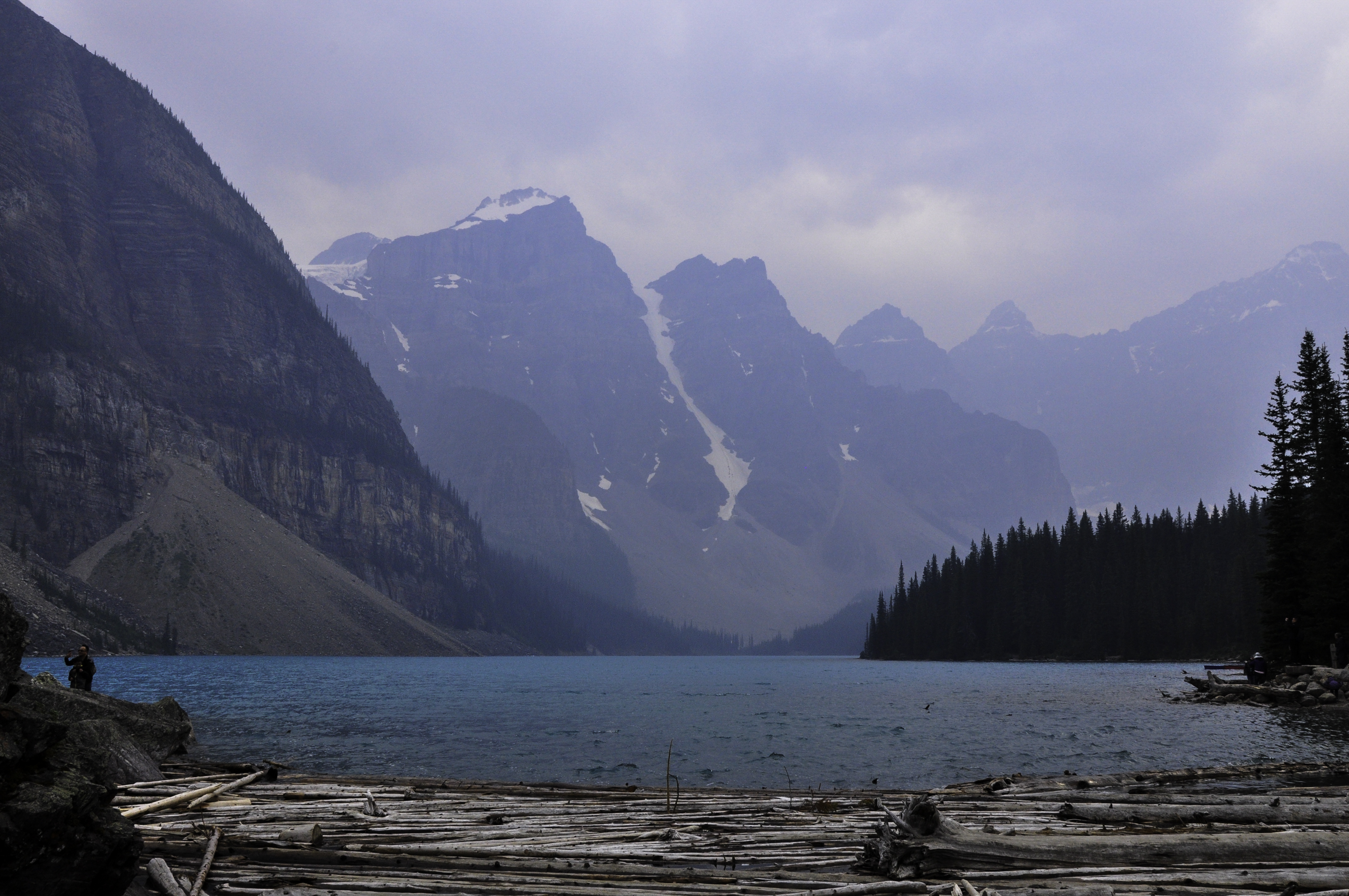
Stupid wildfires.
We drove north, towards Jasper, along the Icefields Parkway. The haze continued and I could see just the edge of so much awesomeness. It was frustrating.
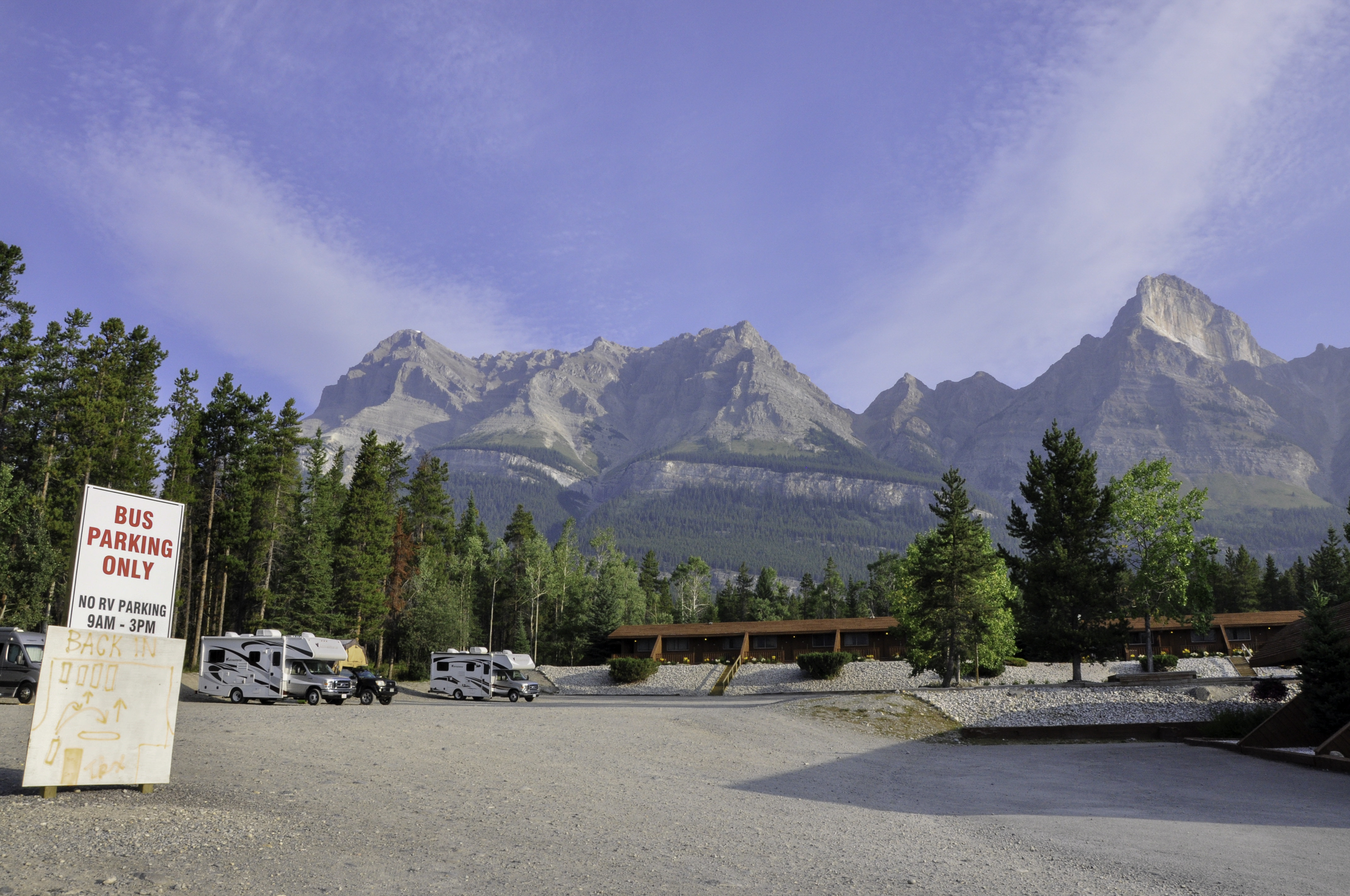
We spent the night at a unique spot called the Crossing. It’s a combination resort and rest stop, one of the few places to get gasoline along the Icefields Parkway. There is a big gravel area that’s reserved for the giant tour buses, but between the hours of 3pm and 9am it’s okay to camp there. Michael actually called them from Lake Louise to make sure our roof-top tent setup would be okay. (We’ve been turned down from other areas that allow RVs because apparently we’re considered a tent and not an RV.)
The Crossing gave us the green light.
I took the above picture at 7am. Mornings tended to be the least hazy. We decided to get (overpriced) coffee from the general store and have RX Bars for breakfast, but move on to a better location to make a real meal.
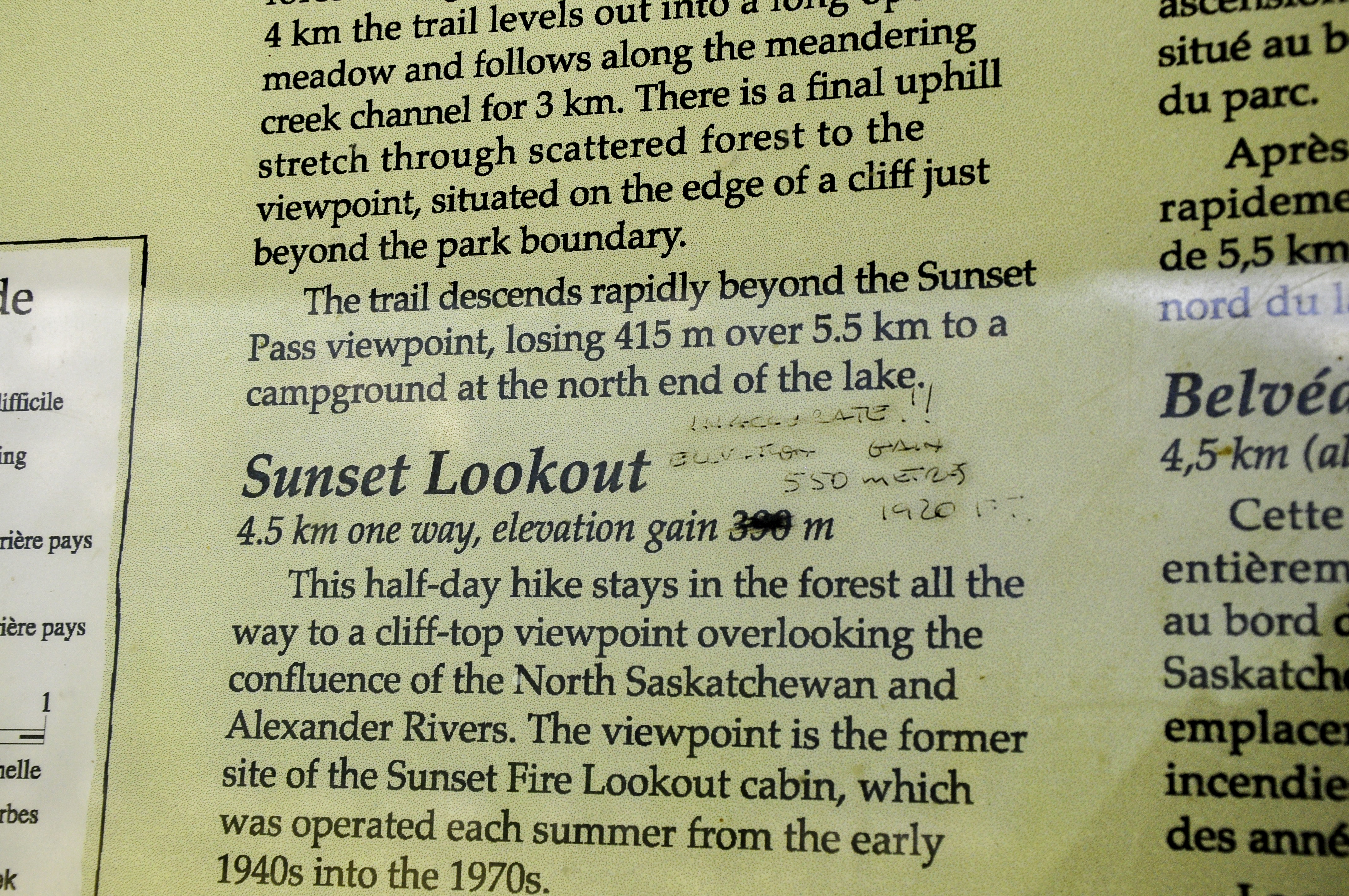
We parked at the Sunset Lookout trailhead. It was about 3km to the lookout, but there seemed to be some discrepancy about the actual elevation gain. Check out what Canadian graffiti looks like:
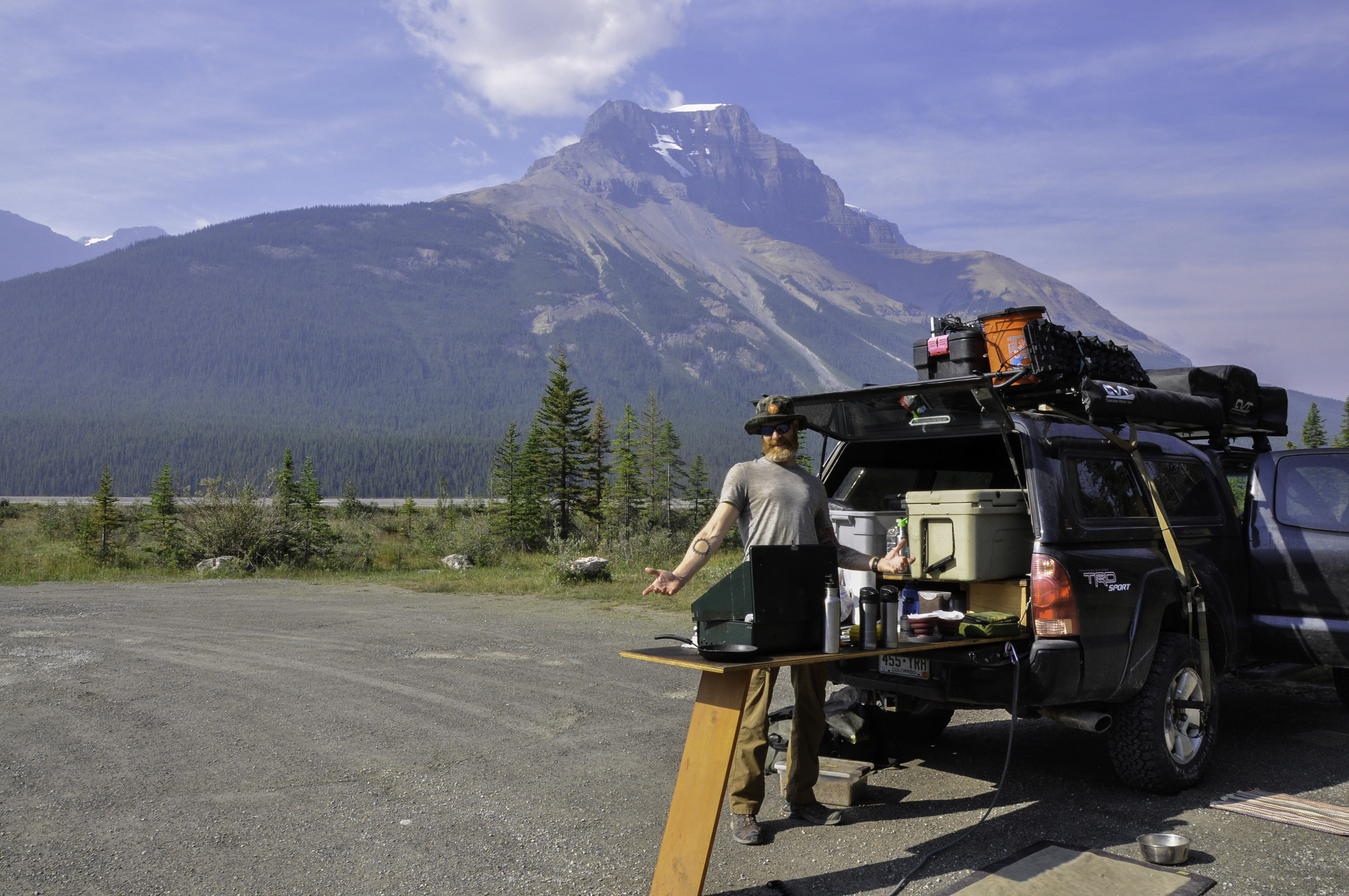
Damn but Canadians are polite. I went for a short trail run, although not all the way to the lookout, and Michael did a crossfit-style workout in the parking lot. Actually my run was more of a power-hike on the way out, but I did run the downhill. It was a lovely trail, nice and technical, and it went by a beautiful waterfall. After our workouts were done we had what might have been the most picturesque tailgate in all of our travels.
It was at this trailhead that we met a nice woman from Vail. (Small world!) She said that to get away from the smoke you needed to get off the Icefields Parkway, which is a valley. That meant north of Jasper, or east/west after reaching Jasper.
This revelation caused a bit of soul searching for us. I mean, we’d come all this way. But the views were awful because of all that smoke. Jasper was a long way from where we were. Hell, everything along the Icefields Parkway is a long way from everything else. Did I mention that gas was the equivalent of $4/gallon?
It sounded like a lot of driving, and maybe for nothing. I won’t lie – this was a hard decision. I was a little crushed as we turned around. But as we headed south we made a pact to come back to the Candian Rockies someday. And next time, not in August. The locals we met said the couple of weeks in September – after the tourists go home but before the snow really starts to fall – is the best. Duly noted!