We spent 4 wonderful days at Indian Creek, and 2 days at Canyonlands. And finally, after almost 20 years, I was able to hike the Joint Trail. This little gem is only about a mile long, and you have to hike 5 miles just to get to it. But it’s a long slot that’s barely wide enough to walk down, with big some jumbo steps over boulders and a log with steps hacked into it at one point. It’s amazing. It’s everything I remembered. And it was totally worth it.
In order to accomplish this feat (11 miles in 4 hours), I left the camera in the car. And I wore my running shoes. This trail has a lot of steeps and scrambly sections, so I knew I wouldn’t run everything, but those flat mesas and the flat washes? I ran those. Michael even paced me, bless his heart. Those long legs of his could have passed me a dozen times over, but he never did.
So I don’t have any pictures of this one. But I attempted this trail with Michael once before (view the blog post here) so you can see the awesomeness.
The next day we were both completely beat. As in, we didn’t want to do… anything. So after a leisurely breakfast we headed back into the Park. I’ve been to the Needles District several times but never driven past the Elephant Hill trailhead. So this time we took the road all the way to the end.
It was a little disappointing.
Not that the scenery wasn’t fantastic. It just wasn’t the same as Elephant Hill. But we did go for a drive on the only 4WD trail that doesn’t require a permit: the Colorado Overlook Trail. It was super fun and Michael had a blast. Wish I could say the same for Bailey. He travels in that crate now, and between that and the cone I think he was getting pretty beat up. So we didn’t go to the end of the trail, but returned early and had lunch in the parking lot of the Visitor’s Center.
By Friday we kinda had to get moving on. Water and other supplies were running low. This time we headed south to Blanding. The Blanding Visitor Center is exceptionally awesome. They have free WiFi and free water! So I was able to send a few emails, check my Facebook status, and then fill up all the water containers.
Our original plan was to head south on Hwy 276 and follow it to Hall’s Crossing, taking the ferry across Lake Powell. It sounded like a cool way to see that corner of the state. And since I’m a cheapskate (and we’re on a budget), I used that wonderful free WiFi to look up the cost of the ferry.
Imagine our disappointment – the ferry is CLOSED until November 25th! What a bummer. It also meant we had to do a quick re-route sitting there in the parking lot.
After filling Taco Negro’s tank at the strangest combination I’ve seen in a while, a gas/station/A&W/bowling alley, we went to the grocery store, Clark’s Market. The last time we passed though this area, we stopped at the grocery in Monticello instead, and for some reason I distinctly remember saying we should have gone to the Blanding grocery.
Either my memory ain’t what it used to be, or Michael and I were smoking crack that day.
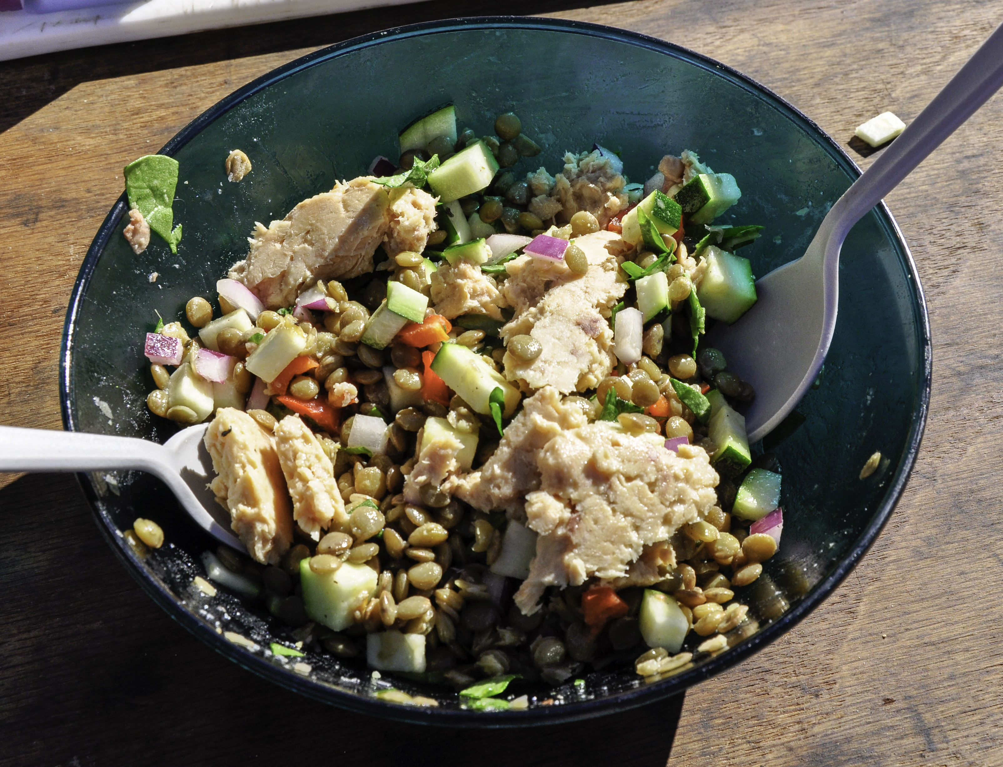
It’s not that the Clark’s Market was terrible. It had a lot of the stuff we’d normally buy. But the bag of mini sweet peppers – the one that’s normally $4, even in Moab – was priced at EIGHT FREAKING DOLLARS. I was not about to pay EIGHT FREAKING DOLLARS for a handful of freaking peppers, no matter how much I like them. We’re on a budget, you know.
So we did the best we could. Unfortunately, the veg was the most expensive area of the store so Michael might have to get creative. Hopefully we’ll have better luck on Sunday in Hanksville. (Not holding my breath, though).
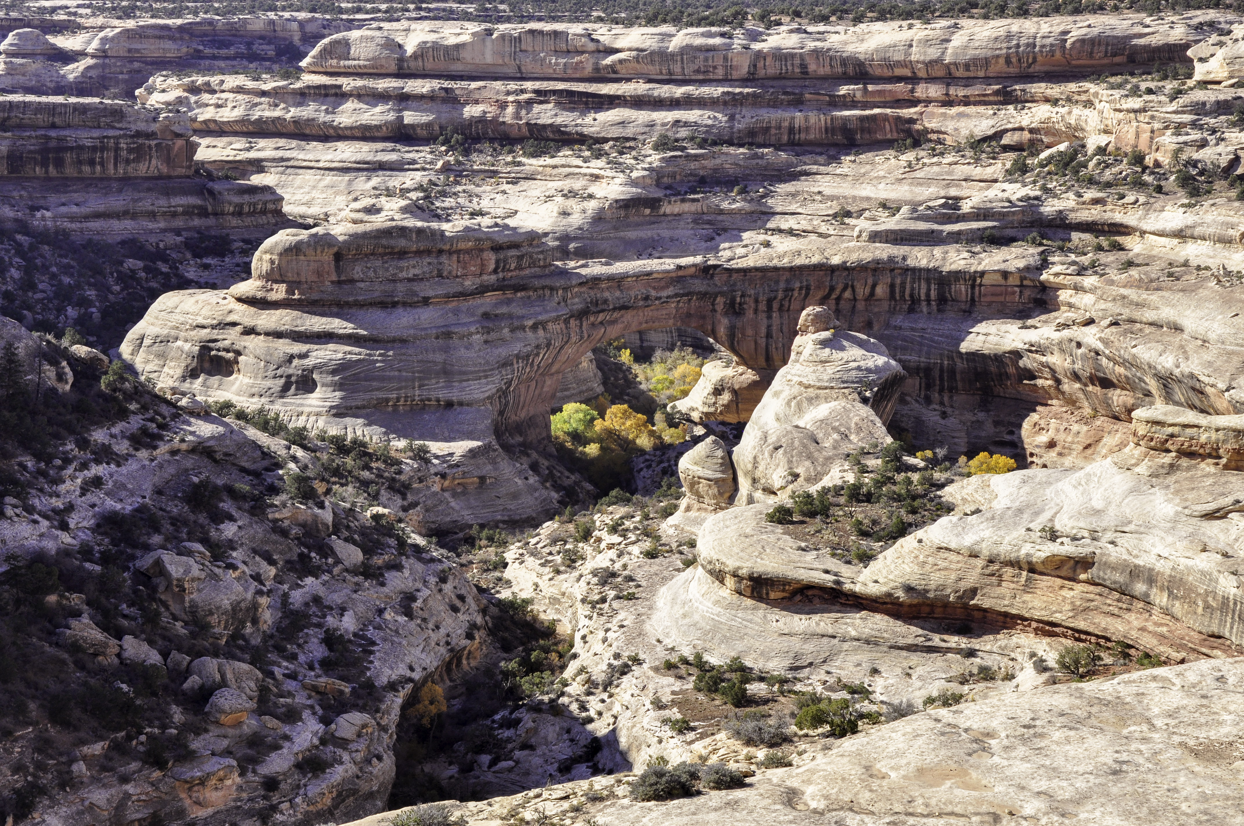
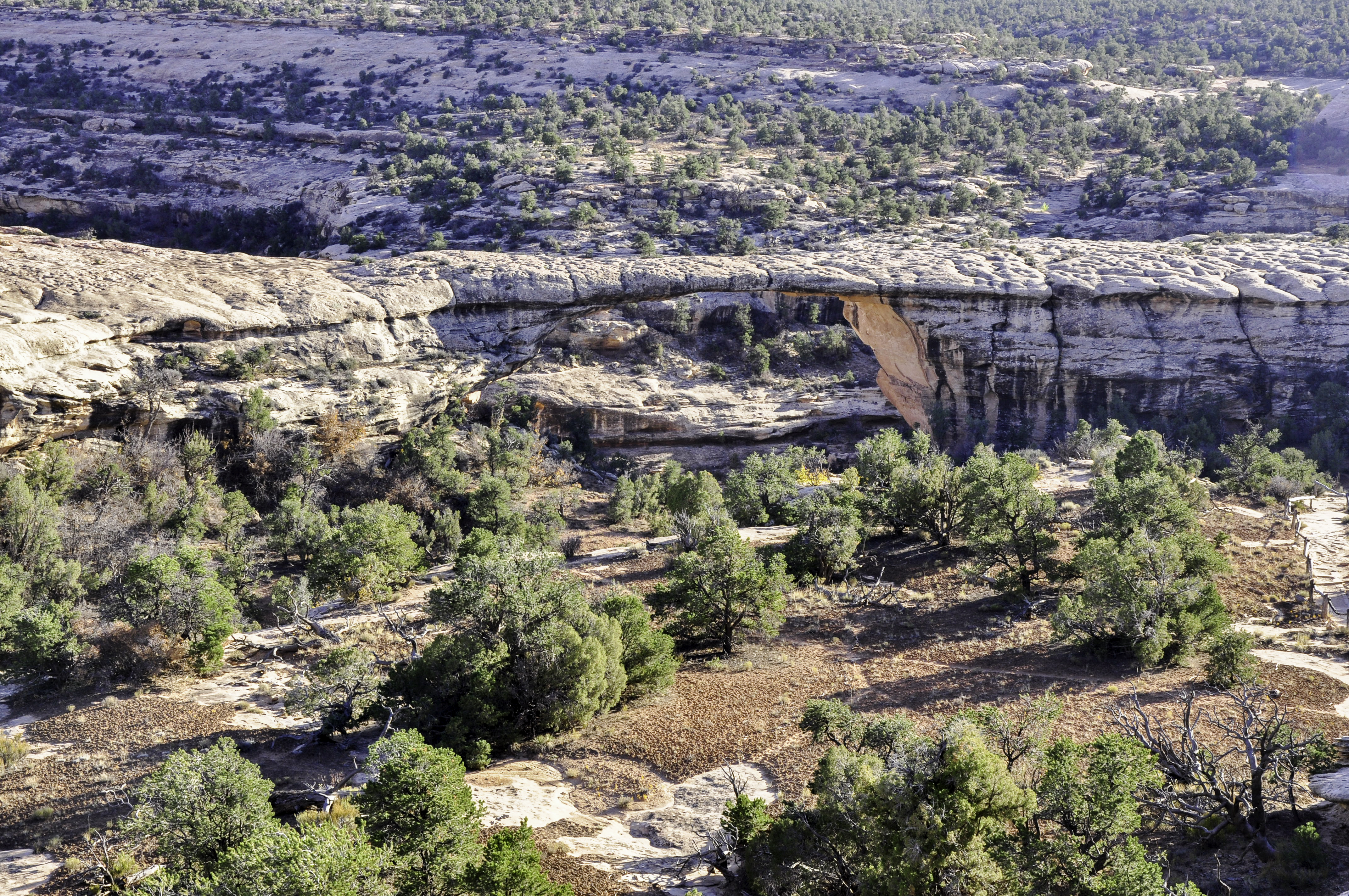
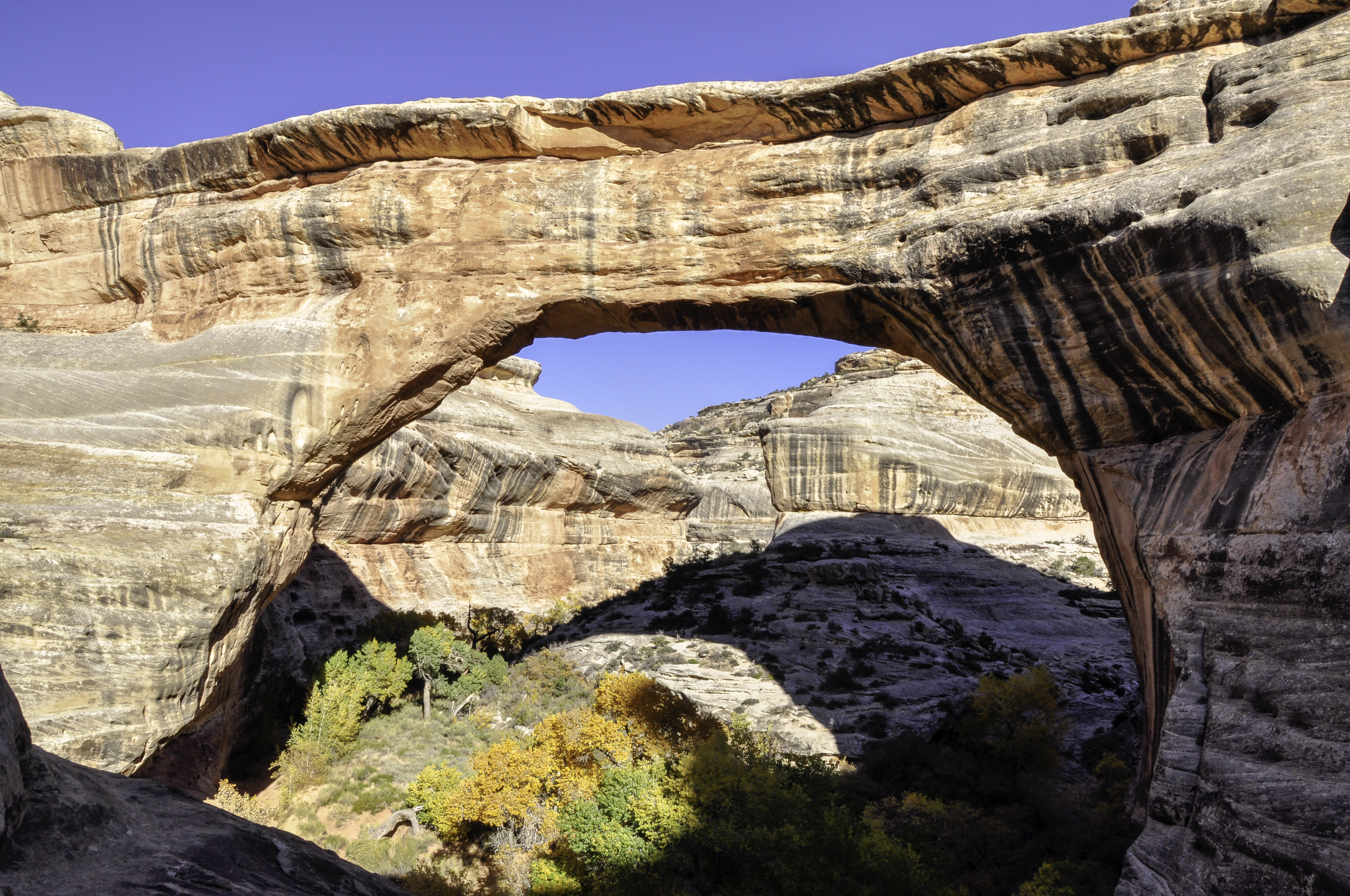
Onward then, to Natural Bridges National Monument. It’s about 30 miles or so west of Blanding, kinda in the middle of nowhere. There were NO crowds here, although that might be because we arrived at 4 o’clock in the afternoon.
There are three main bridges in the park, and we saw all of them.
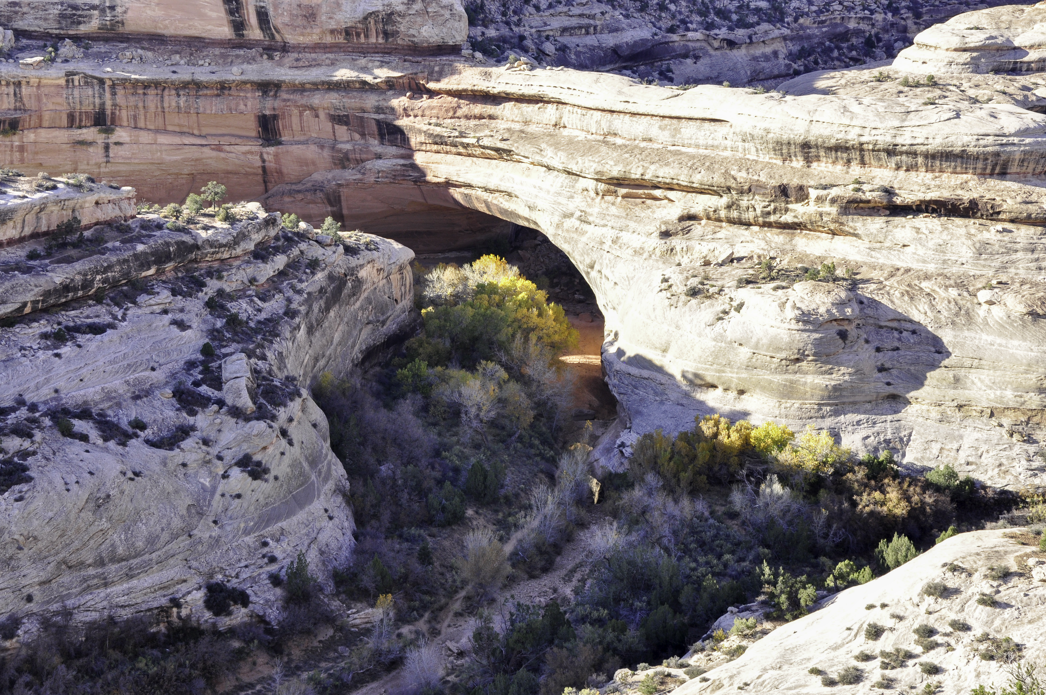
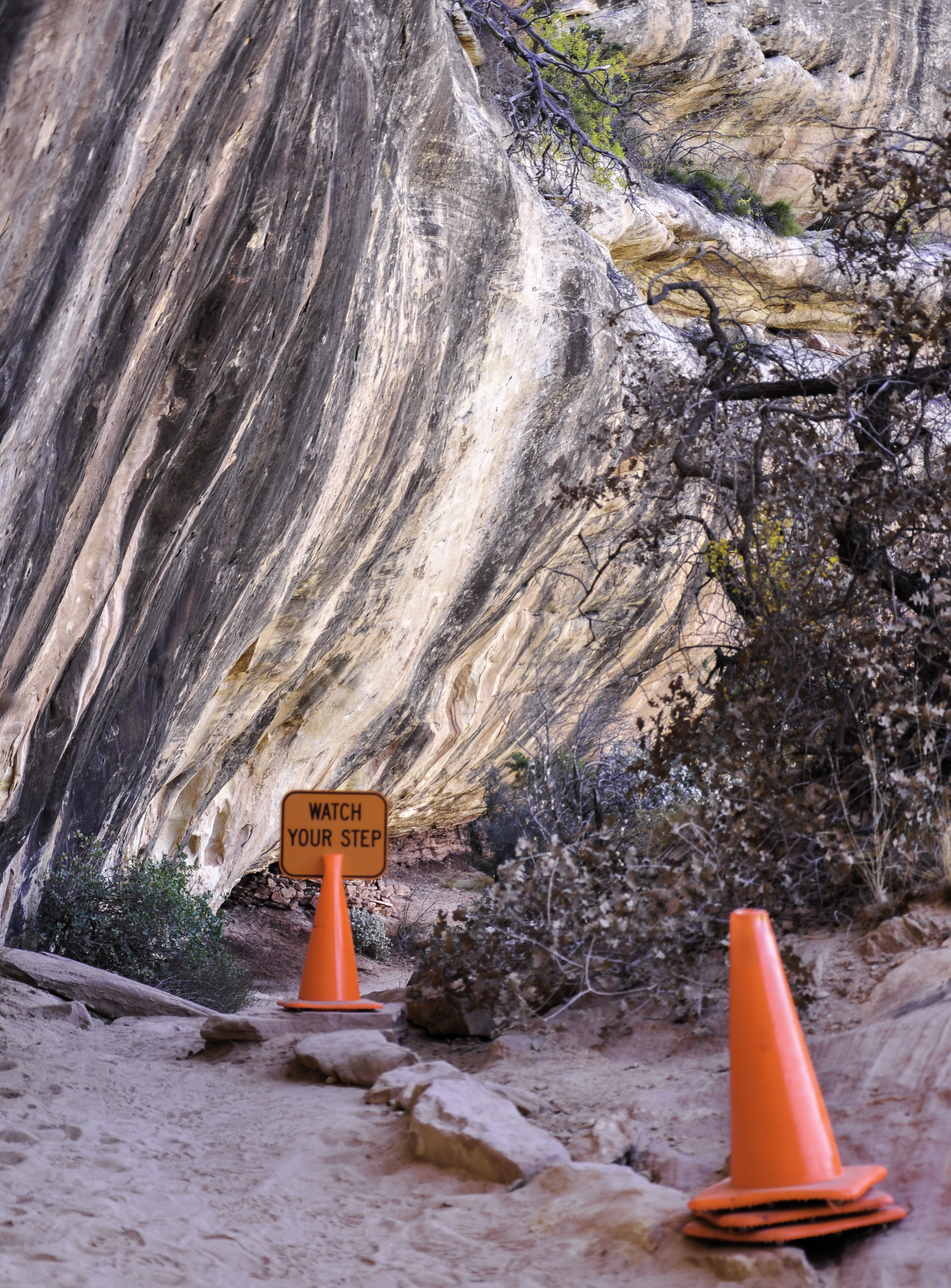
We even hiked down to one, Sipapu Bridge. The trail is .6 miles each way, with an elevation change of 500 feet. There were ladders
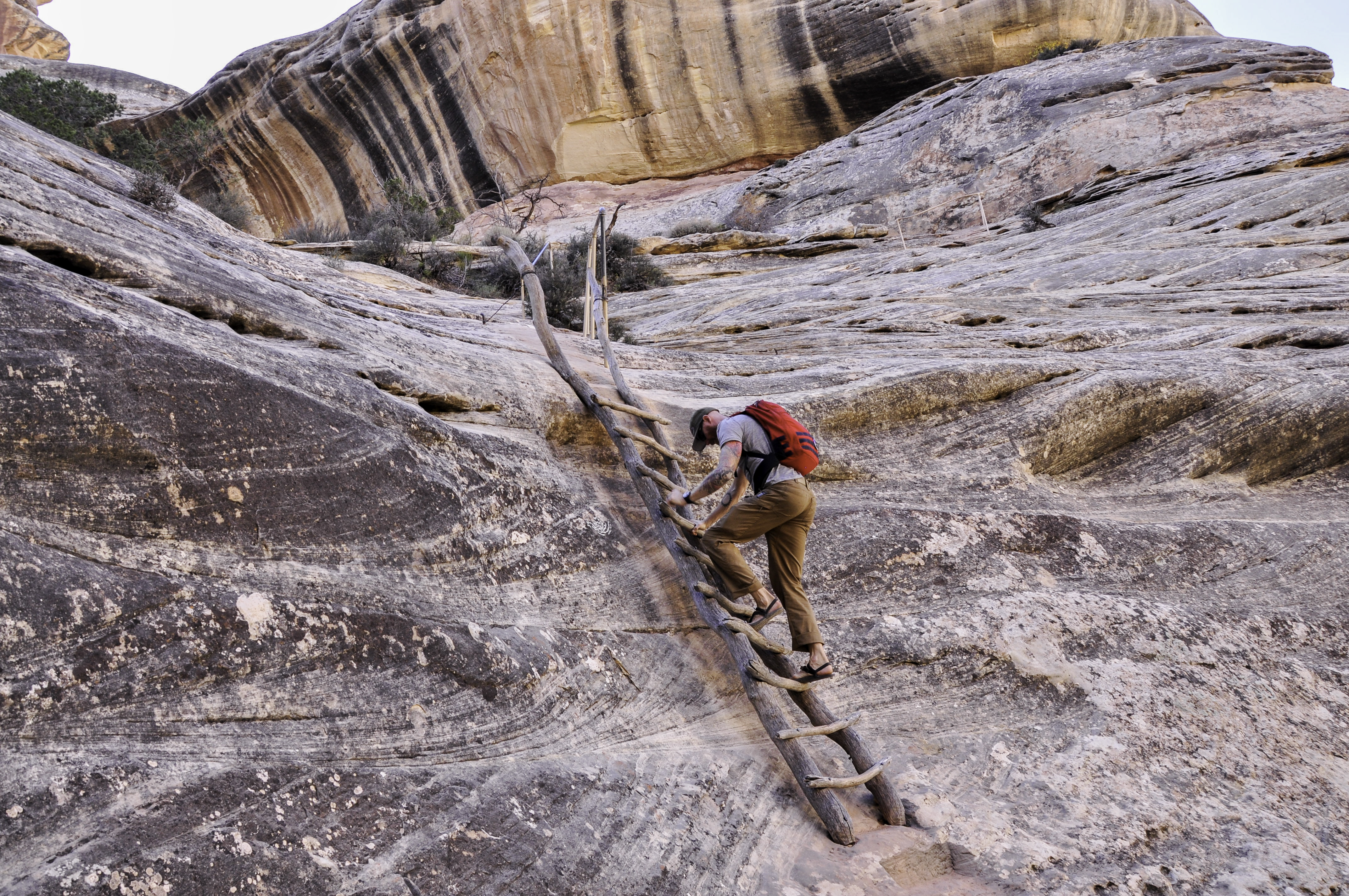
and stairs and handrails and (at one point) a sign that said Watch Your Step.
If it had been a lot longer it would have been my kind of trail. In case you’re wondering the difference between an arch and a natural bridge: “Natural bridges are formed by the erosive action of moving water. Arches are formed by other erosional forces, mostly frost action and seeping moisture.” That’s from the little pamphlet you get when you enter the park. Neato!
We camped on a BLM road that I don’t remember the name of, one that turned out to be pretty popular as we saw half a dozen occupied sites before finding a wide open one maybe 2 miles in. Nice and flat, too!
Our current plan is to head towards Hanksville on Saturday and hit Goblin Valley State Park on Sunday the 23rd. We want to hike the slot canyon (Little Wild Horse Canyon) and the weather forecast on Monday is a chance for rain.
One last note: I mentioned that Elvis has been sleeping up in the tent with us, kind of grumbling about it. Well, I have to say that Elvis just seems happier now. To put that in more quantifiable terms, he is more affectionate and more obedient. Crazy.
Comments
3 responses to “Canyonlands, Take II”
Glad to see you’re hitting Little Wild Horse and Goblin Valley – those are two of my favorite fairly easy access places in southern Utah. Coyote Gulch and Davis Gulch are also fantastic but harder to get to.
Yes! Thanks so much for the suggestion!
We soooo enjoy your keeping all interested up to date. Wish we could leave a meep