Where I debate my toughness (or the lack thereof)
In my last post I was camped in the parking lot of Parowan Petroglyphs, about 15 miles from the Utah town of Cedar City and at an altitude of almost 6,000 feet.
The overnight low was 38o, or so the Weather Channel told me. I slept well – like I said, with the windows closed down, the topper is actually quite mild. 38 is not all that cold, anyway. Still, I waited as long as I could for the sun to rise. It did, of course, but the sky was completely overcast so the temperature didn’t go up by much.
Why am I such a wimp about the cold?
Part of it is real: I have Raynaud’s Disease (something that sounds a lot worse than it is). I’ve also heard it called Raynaud’s Disorder, which somehow sounds better. Disease sounds like… I don’t know, leprosy or something.
And all it means is that when my hands get cold, the blood vessels in my fingers narrow excessively. Blood can’t get to the surface of the skin, so my fingers turn white and lose all feeling.
This can happen on a cold morning. It can also happen on a 70o day, if I pull a cold bottle out of the refrigerator. But it’s a lot easier to warm my hands up on a warm day.
Actions like getting out the metal stove, and then the metal pot I use to heat up water for coffee… well, there went all the feeling in my fingers. I have wool mittens and they help but I can’t exactly wear them while trying to light the stove.
So when I climbed out of the back of the truck on that chilly and overcast morning, my first thought was to chuck it all and just drive to the nearest Denny’s. I would swear they had one in Cedar City.
Then I remembered that Cedar City was about 15 miles away. I wanted coffee. Now. Coffee is warm and it’s pretty easy to make. So I stood outside in my down jacket and my earflap hat and my Uggs with my hands in my armpits while I waited for the water to boil.
Coffee cures a lot of ills, but I gave up on Capitol Reef. Not easily, but… Was I supposed to live on Rx Bars for the rest of the week? When I checked the Weather Channel, they showed the high temperatures in Torrey, Utah (the town closest to the NP) at 50, with cloudy skies. Overnight lows of about 30. Too cold (for me) to cook. Too cold (for me) to keep warm hanging out at a campsite.
I cursed myself for not being tougher as I headed south, back to St George. I found a site on BLM land (I swear 80% of the state of Utah is owned by the Bureau of Land Management) near something called Fort Pearce.
The clouds followed me the whole way and it was not much warmer at Fort Pearce.
It was warm enough for me to make a meal, though, and then check out the Fort.
I guess the BLM doesn’t have an educational directive, as there was zero signage explaining the area. Who built this fort? When? Why was it abandoned?
Thank god for the internet.
“Fort Pearce was built and occupied by Mormon settlers desirous of maintaining agricultural communities in that part of southern Utah. Although the direct purpose in building the fort was to keep Navajos from raiding settlements, its corral proved to be its most useful asset, in keeping livestock from destroying valuable crops.
Fort Pearce was built during the Blackhawk War of 1865-1868, a period of conflict with the Ute Indians in central and southern Utah. This was Utah’s last major Indian conflict. During this time the Navajo Indians also raided the settlements of southern Utah. The Navajos used Fort Pearce Wash as a means of gaining entry into these Mormon settlements. The fort was built in 1866 to keep out the Navajo raiding parties. No battle was ever fought with the Indians at the site.
The fort and the wash upon which it is situated is named for Captain John D. L. Pearce, noted military leader and Indian fighter from St. George, Utah, who took part in the Black Hawk War and other Indian conflicts in southern Utah. “
http://wchsutah.org/geography/fort-pearce.php
Except, I had basically no internet connection while I camped in the area, so I had to look all this up later (like, when I was writing this blog post). And I’m not really sure I want to learn more about someone who’s a “noted Indian fighter.”
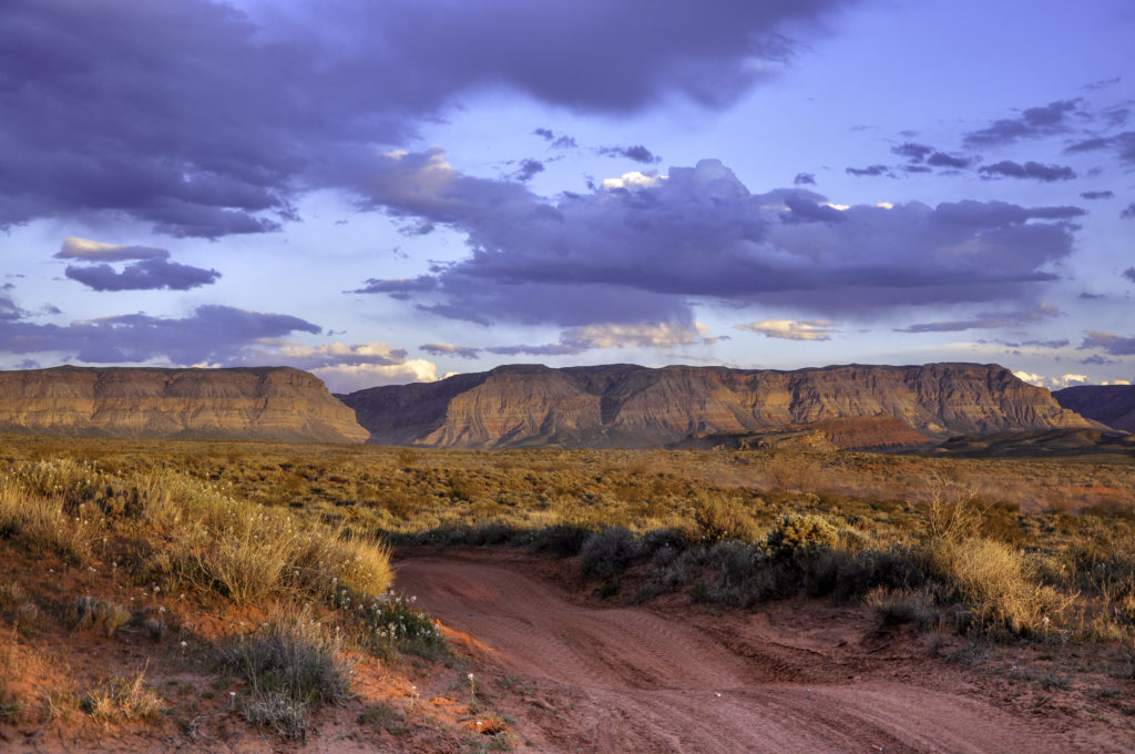
Anyway. The skies continued to be overcast for most of the day. I went for a little hike along the wash next to the Fort, which kept me warm. Then I went searching for an unoccupied campsite.
Fort Pearce is big with the OHV crowd, and most of the areas for camping that I came across were large and already full of several giant RVs. I kept going until I saw a little spot that caught my eye.
It was terrible. Seriously.
My little spot was trashed with dirt bike tracks and shotgun shells and the remains of somebody’s target practice. It was not even remotely level.
But it was open and I successfully backed into it, and then successfully leveled the truck.
Right about the time I shut off the truck for the day, the sun came out. And it completely transformed the area.
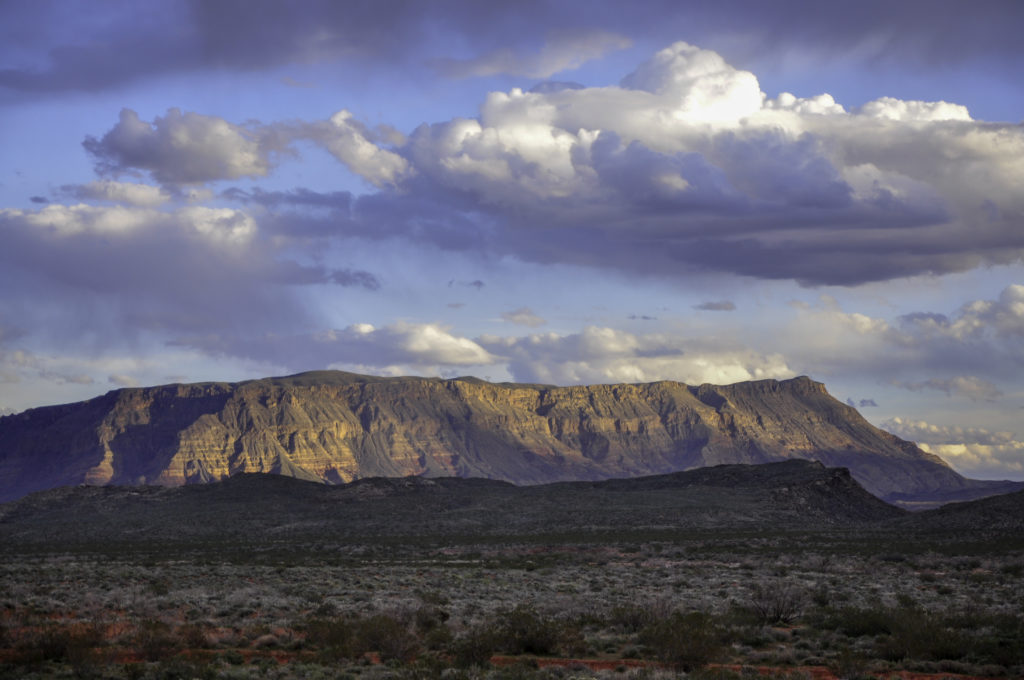
It was still warm enough for me to make dinner and then watch the sun set before crawling into the truck for the night.
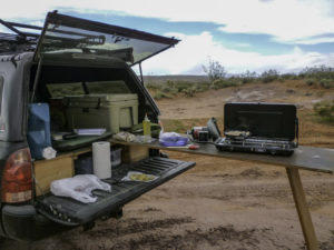
If you follow my blog, you might notice that the table normally rests on the tailgate of Taco Negro, not the storage platform. That’s how not-level my spot was.
Maybe heading south wasn’t such a bad idea, after all.
Comments
2 responses to “Fun At Fort Pearce”
soooo well written, as usual.
Enjoy these so much
So glad to see your adventures, again, and read your Spot On info! Love you,
Theresa